EN
EN DE
DE
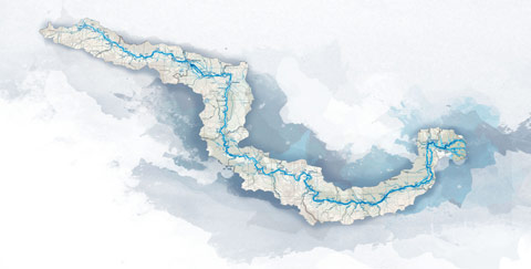
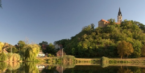
Cycling trail in Serbia, SECTION 3: Backa Palanka – Novi Sad
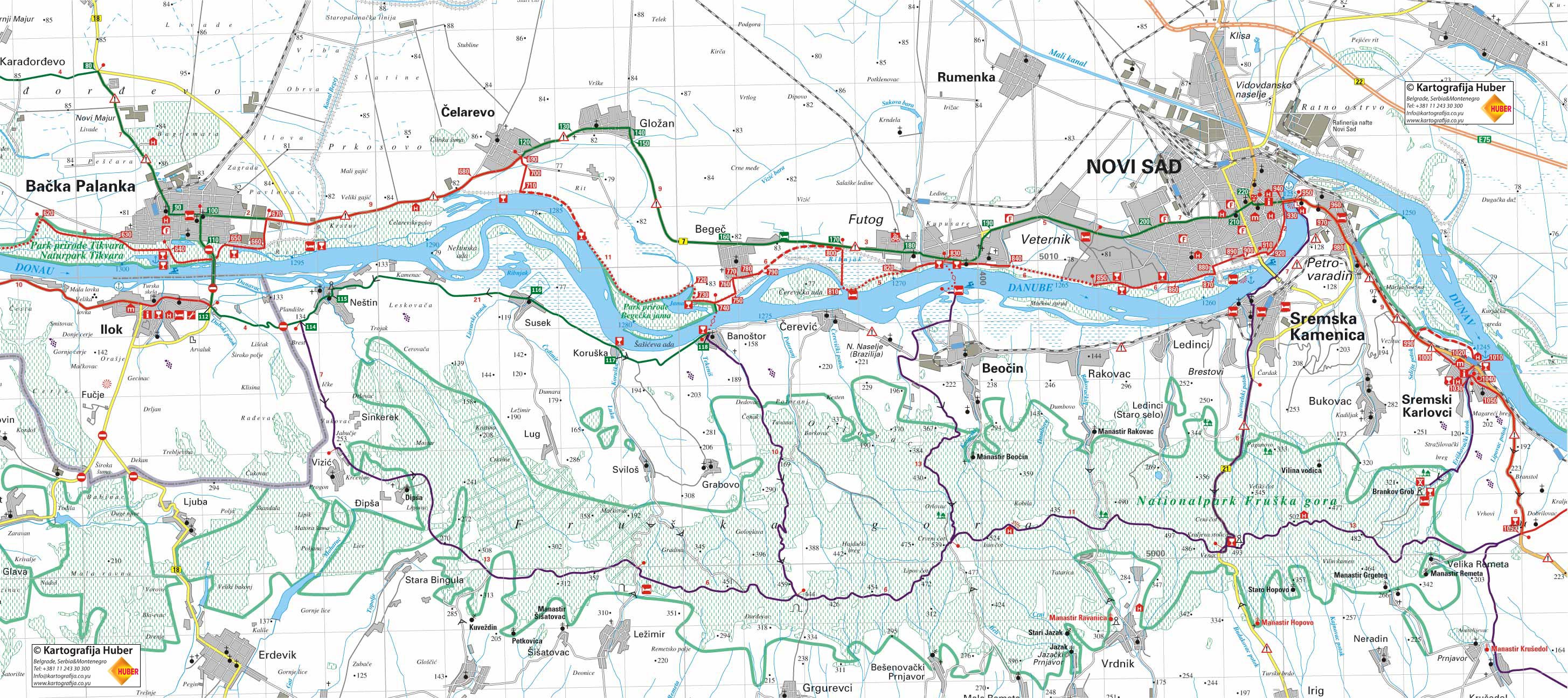
Backa Palanka, centre (pedestrian zone, near the church) – 0km From the centre we move straight ahead, direction east. The central street (continuation of the pedestrian area) turns into a main road to Futog and Novi Sad. The traffic in this street is very intense. Alternative: cross over to the r...
City: Backa Palanka
Country: Serbia
Cycling trail in Serbia, SECTION 3: Backa Palanka – Novi Sad
- Map (878Kb)
Section West: (Sections 1- 4: Backi Breg - Apatin - Backa Palanka - Novi Sad - Belgrade)
Section East: (Sections 5-7: Belgrade - Pancevo - Ram - Golubac - Đerdap - Kladovo - Negotin - Bregovo)
E – Food
U – Sleeping Accommodation
Note: Complete text and GPS marking was done by Ciklonaut Serbia, e-mail: jone@ciklonaut.com
If we decide to take this route we have to turn right in the centre of Backa Palanka, direction south. We will drive across the border to Croatia, pass the bridge “25.maj” and arrive to Ra5. It is about a little more than 3km from the centre of Backa Palanka.
Ra5: 0km
There is a 1.2 km long rise, altitude of 85m to 125 m right after this intersection followed by a downhill ride to the bay of a local stream and directly after that, near the border crossing, another ( shorter but sharper) rise.
2,7km (127m above the sea level)
We cross the border entering Serbia from Croatia.
3,5km (130m above the sea level)
Ra6 – the right direction is for the village of Vizic and to Fruska Gora, but we move on straight ahead. Our road leads down to the village of Nestin.
5,1km (100m above the sea level)
Nestin, middle of the village.
5,4km
A monument is on our left side. A beautiful view of the river – if the surrounding bushes are trimmed.
12,3km (82m above the sea level)
Susek, centre.
15,7km (83m above the sea level)
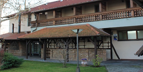
Entering the village of Koruska a left road leads to the Koruska Restaurant (E), to the guesthouse Dunavska terasa (Danube terrace) (E, U) and the camp area (U), 180m away.
A 1 km long rise begins here.
16,1km (110m above the sea level)
Ra7 – At the end of the village a road turns right to Svilos and Lezimir (Fruska Gora) – we drive straight ahead.
16,6km (136m above the sea level)
End of the rise, the highest point on the way from Ilok to Banostor. The road leads down to the village of Banostor.
19,0km
Vinarija Sijacki (the vineyard “Sijacki”) (E, U) on the left side of the road.
19,5km
Entering the village of Banostor we turn to the left to a ferry dock to Begec 100m away. We take the ferry to the other side of the bank and continue cycling to Futog (main bicycle route). The departure time: every 30 minutes. The prices are 30 dinars per person and 150 dinars per car. There is a restaurant ‘Jole’ next to the dock (E) ( fishermen’s club).
Possibly we could drive another 11km across the village Cerevic to Beocin, where there is another ferry to Futog on the left bank of the Danube. Working hours from 7am to 7pm, every 30 minutes. The prices are the same as for the ferry to Banostor). Car transport also possible. Nearby the dock there is a sandy beach (not particularly maintained), restaurant Karas (E,U) ( fine rooms with nice wooden furniture; big lawn in the front, very convenient for setting up a tent- ask for the permission in the restaurant).
We do not recommend cycling on the right bank on the Danube after Beocin: the asphalt is bad and the traffic is more intense. From Sremska Kamenica to Petrovaradin the road is narrow and the traffic very intense – a frustrating situation.
2,2km
We pass the intersection Rd25 where on the right side the local asphalted detour completes, mentioned at the end of the previous section.
2,9km
R33 – To the left we have the bypass around Backa Palanka. We continue straight.
3,9km
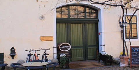
To the right of the main road a macadam road leads to Czarda Florida (E,U), 1.2 km away.
Heading to this Czarda, after about 600m we reach a V-shaped intersection, where we continue semi-right. We can camp by the Czarda (wild camping ground). Across from Czarda, on the other bank of the river there is a “Zeleni Sprud”, a sandbank, a popular local camping ground during the summer (this camping ground is not upgraded, but there is a restaurant).
Two more kilometres from the Czarda Florida (the road through the woods is not asphalted), there are a weekend-colony Florida and the beach.
Why not moving from Czarda Kalos to Czarda Florida on the bank-road?
Right after the turning to Czarda Kalos the asphalt turns into a bad earthy road passing by the city damp.
7,2km
Driving by the motel Poloj on the right side of the road (E, U).
8,9km
R34 – we head straight on the main road. By a house on the right side there is a little road leading to the bank. At the beginning there is a barrier, usually closed but with enough space for a bicycle- pedestrians and cyclers are allowed on the bank. Anyhow, the earthy road behind the ramp is fairly bad which is why we recommend staying on the main road for a while longer.
9,3km
R35 – a V-shaped intersection. The left road leads to Celarevo, but we go right.
11,1km
R36 – This is where we leave the main road and head right on the asphalted road.
Alternative: main road through Glozan, Begec and Futog to Novi Sad (25km, green line on the map)
In case of heavy rainfall the earthy sections, which there are a few in the following part, could be a problem, so it is better to stay on the main road.
R36 – 0km
1,9km
Ra9 – a V-shaped intersection. Left road leading through the centre of the Glozan village (parallel to the main road).
2,7km
Glozan, centre.
4,4km
Ra10 – Again on the main road heading straight. There is a gas station at the intersection.
10,0km
Ra11 – Turn right to the centre of Begec. We continue straight on the main road.
11,6km
Salas Cveja on the left side of the road. Right before the Salas, on the right side of the road, there is a restaurant ‘Stari As’.
13,7km
Ra12 – heading straight to Futog, to the right an asphalt road begins which can take you to the main route. 100 m after (R45 – see below).
15,4km
Futog. In case you need spare parts for the bicycle a street on your left will lead you to a shop called ‘BIS’ ( 360 m).
19,2km
Futog, beginning of the cycling path on the right side of the road.
20,1km
We are now in Veternik; a street on your left leads to a well-equipped cycling shop/ service ‘ Biciklo centar Blesa’ (260 m).
22,8km
Ra13 – entering Novi Sad we leave the congested main road and turn to the river.
23,4km
Ra14 – at this intersection we turn left.
24,8km
R45 – Intersection where we join the main cycling path alongside the Danube.
11,4km
R37 – a V-shaped intersection where we turn right.
12,4km
R38 - Exit on the bank of the Danube. On the right there is a road leading from Point R34 (1,6km). On the same side of the bank there is a road leading to a nearby weekend-colony and some 500m distant restaurant Saran (E) (translated; carp). We head left, there’s no more asphalt on that side so we have an 8km long earthy section.
15,1km
A path on the right leading to a nearby Czarda Lozani (E). Czarda is very well situated so it’s worth taking a break on its terrace in the tree shade. Up till this point the earthy road was good, but further on it’s pretty dusty ( if the summer is very dry you are in for a real ‘desert’ ride) However, the scenery and the atmosphere is exquisite.
20,1km
R39 – we will turn right here remaining on the bank which approaches the Danube along the Jama Lake.
20,5km
R40 – We are coming to an asphalted road. We have to turn left to Begec, but before that it’s worth stopping by at a 300 m distant Czarda on Jama Lake (E,U), which is surrounded by trees and water and has a wonderful terrace with a beautiful view. You can camp here for a really low price. We will turn right at R40 to get to the Czarda.
21,3km
On the right side of the bank there is a path to the ferry-dock Begec-Banostor (400m). The ferry leaves every 30 minutes and costs 30 dinars per person and 150 dinars per car.
22,0km
R41 – The asphalted road turns left to the centre of Begec (1,3km), but we continue straight on a good earthy road going along the bank. This part is 4km long.
24,2km
We arrive at a huge fishpond which is actually a lake which fills in all the marshes between Novi Sad and the river.
26,2km
R42 – We are on an asphalted road again. Turning left you come to the 100m distant main road; we will turn right on the asphalted road which leads over the fishpond.
27,5km
R43 – the end of asphalt in a V-shaped intersection. We follow the left road which leads us to a weekend-colony. Nearby intersection there is a beautiful Czarda Dunavac (E, U). Note: if the water level of the Danube is high the populated part can be inundated or some parts can be extremely muddy.
28,0km
After we have passed the colony we continue driving on the bank-road and move on to Futog. Here the green landscape, the water and the air around us is fulfilled by the voices of waterfowls so that it seems to us as if we were in the middle of a jungle. Everything else is distant enough so we can enjoy the real experience.
29,5km
R44 – At this T-shaped intersection an earthy road parts on the left but we will turn right to the beginning of the asphalted road on the bank.
30,8km
Czarda Mika (E).
31,0km
On the right side there is an access road to the ferry-dock Futog- Beocin ( 60m) The ferry leaves every hour from 6a.m. to 8 p.m. ( in winter from 8 a.m. to 18 p.m.). The ferry is closed only during the fog and when the river is completely frozen. Prices: 30 dinars per bicycle, 150 dinars per car.
31,4km
The restaurant Splav (E). We drive near the centre of Futog, so we can see a beautiful church over the roofs of the nearby houses smiling at us. The traffic is light at this part of the bank but we will encounter a lot of pedestrians, hikers, fishermen … - the road we are driving on is actually a street.
33,2km
Another non-asphalted section begins. It is 2.8 km long mostly with a bad tarmac; however, you can drive safely on a good weather. Comfort: It is calm as oppose to the main road to Novi Sad.
35,0km
We reach an asphalted road.
36,6km
R45 – On the left there is a road with which the alternative drive-route (Golzan-Begec-Futog-Novi Sad) merge into the main route.
37,2km
Turning right to a Czarda Kamenjari (E.U) which is situated in the same weekend-colony on the riverside. The Czarda is in a very beautiful place and the gypsy music is often played here.
38,5km
There is a very interesting restaurant on the left beneath the bank called ‘Ribarska noc’. (E)
38,9km
R46 – We are already in Novi Sad and we will make a turn at a V-shaped intersection.
42,6km
Avoiding the shipyard we get back to the bank of the river which is now a beautiful and cheerful pedestrian area. We are only left to choose and adequate street to lead us to the city centre.
44,9km
Novi Sad, centre.
*Remarks:
1. Regarding waypoint you are interested in always check in your GPS the field with its additional description: there you can find full name of the waypoint as well as various additional information.
2. Waypoint system is designed to show direction down the river; for example waypoint “asphalt start” means the asphalt starts at that point when you have in mind defined direction – if you travel up the river stream this would then be the place where asphalt ends.
3. Situation at the field continuously changes, therefore GPS data here given can be changed or updated – that is why we recommend that you download the data from the web site right before the planned journey.
4. If you find some inaccuracies or you wish to add some new GPS data you find important, please inform us using this address.
Explanations for abbreviations used in waypoint denotations:
• Number without any letters: number of the crossroad at the main route (corresponding to the number on the map and number on the sign-post at the field)
• Alt + number: number of the crossroad at alternative route (corresponding to the number on the map and number of the sign-post at the field)
• D + number: number of the crossroad at detour
• S: turning point
• Vo: water (spring, drink-fountain etc.)
• asf st: beginning of the asphalt road
• asf end: end of the asphalt road
• cycl: bicycle parts selling store and/or bicycle service and/or bicycle center
• Muz: museum
• Ht: hotel
• Mot: motel
• P: pension
• car: čarda (fish restaurant)
• kaf: tavern
• T: tunnel
• Names of inhabited posts are written with capital letters
DANUBE.TRAVEL has no control over the website content generated by users and/or visitors, neither such content represents a statement, opinion, recommendation or rating by DANUBE.TRAVEL. For further information please refer to DANUBE.TRAVEL – General Website Terms and Conditions of Use.
Places near this location
Where to stay
What to do

Sanctuary, Church and Friary of St. John of Capistrano
To be buried at the fortress of Ilok was the last ...
Danube experience