The Danube is a river of diversities, in all possible aspects. Geographically speaking, it changes constantly - its width, its depth, the landscapes around it, are never the same. A visitor eager to see all of the Danube's2857 kilometres, has the opportunity to visit many rivers at the same time: a mountain river, than a river that flow through the plains, a river surrounded by steep cliffs, a river that slowly conquers endless fields.
The German section of the Danube winds its way through Baden-Württemberg and Bavaria, covering 199 kilometres through Baden-Württemberg and 448 kilometres through Bavaria. After the Black Forest, where it raises, it flows past a wealth of glorious countryside: rolling Alpine foothills, through a long and narrow strip of Southern Germany, pass the Lake Constanca and Lake Chiemsee. Finally, it heads towards the Bavarian Forest.
In Austria, the Danube flows for 350 km. Its banks in this country are as diversiful as they can be: wooded, steeply overhanging riverbanks alternate with fertile plains, luscious pastures and vineyards.
Something different happens in the next segment of the river -in Slovakia, Hungary and Croatia. In all of these countries, the Danube runs through plain lands, with only a few hills on its sides. Its 172 km in Slovakia, the Danube runs along silhouettes of old towns and monuments, woods and picturesque fields - very wide and slow.
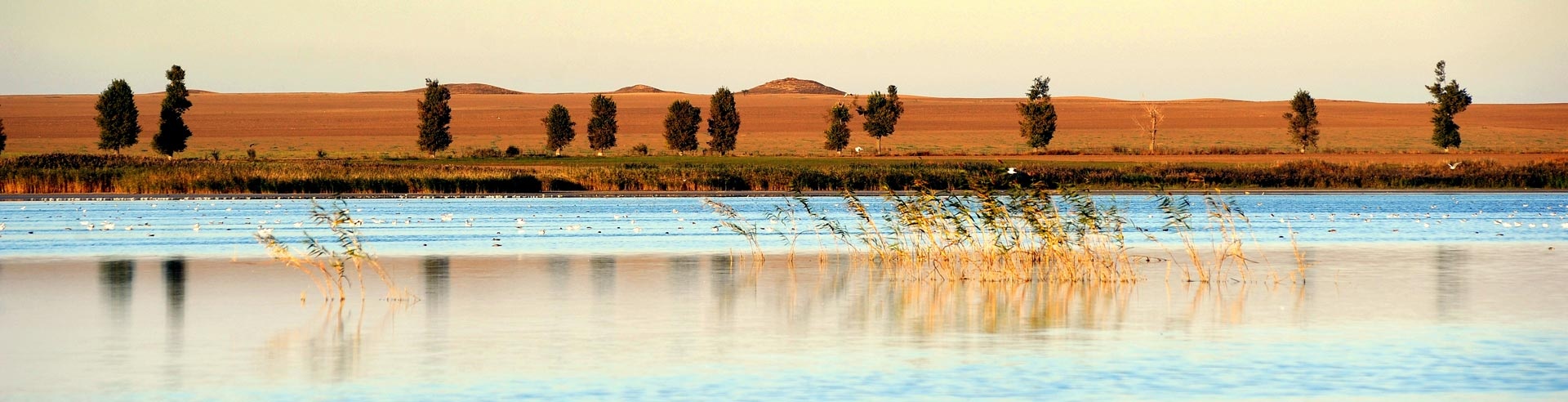
Hungarian part of the Danube is 417 km long and cuts through hilly, Southern extension of the Carpathian Mountains. The river divides the country into the Great Plain on the East, and Transdanubia Plain on the West. Flowing along its 188 km in Croatia, the Danube passes through serene and beautiful Pannonian Plain. The river's path through this country, ends in Kopacki Rit - National park which is home to a large number of specific bird and animal species.
Croatia and Serbia are bordered by the Danube, so the first part of Serbia's 588 km is the same as the Croatian: flat plains alternate with a rather hilly ones. After Fruska Gora low mountain complex, it changes, and in the Eastern Serbia becomes a mountain river. On the border of Serbia and Romania, the river separates Carpathian Mountains on the Romanian side, and the Balkan Mountains on the Serbian side. It carved its passage through the mountains and now flows through the largest gorge in Europe. This part of the river - the Iron Gates, is one of Europe's most scenic landscapes. The Danube banks on both sides of the border are under state protection as national parks.
The longest portion of the Danube runs through Romania. For more than thousand kilometres, its banks change from the steepest cliffs, into a swampy plains. It borders the country from the East, at the the Iron Gates, and after that it broadens and forms most of the state border to Bulgaria. The valley of the lower course of the Danube in Romania is flat - at Galati, the river divides into an expansive delta, before entering the Black Sea. Northern branch of the delta runs along the border between Romania, Moldova and Ukraine.
Total length of the Danube in Bulgaria is 480 km. At the border with Romania, it flows pass the foothills of the Balkan Mountains. The further we go, the landscapes turn into hilly or flat land, dominated by forests, swamps, islands and riverside marshes. Geographically speaking, The Danube in Ukranine and Moldova doesn't change much in comparison to its lower part in Bulgaria. The only mountains in Ukraine are in the West and extreme South of the country, and the Danube's 160 km - forming the border with Romania - are far away from them. Moldova has access to the Danube for only about 480 meters, and those are flat as well.
There are a large number of significant landscapes along the Danube, and many of them are under state or international protection. The first impressive region is the Black Forest, where it rises - mount Feldberg is the tallest peak in Germany, outside of the Alps. In Austria, the most famous and important nature highlights are: the Danube loop in Schlögen, where the granite bedrock of the Bohemian Massif forces the river into a double change of direction, and breath-taking Wachau Valley, which was declared as UNESCO World Heritage.
The river becomes Slovak at the point of its confluence with the Morava, beneath a castle rock. This monumental rock, more than seventy meters high, stands over the Danube's entrance to the Devin Gate, through which the river overcomes the narrowest projection of the Small Carpathians.
The Danube Bend in Hungary is also one of the sites that visitors never forget. Between the towns of Esztergom and Szenntendre, the river turns sharply to the South in the direction of Budapest, forming one of the most exiting and beautiful landscapes of the Danube.
In Croatia, a visitor can enjoy the nature of Kopacki Rit, where only birds' and animals' sounds spoil the absolute peace and quiet. Serbian part of the river offers the calmness of the Pannonian plain, vineyards of Fruska Gora, river Sava confluence at Serbian capital Belgrade, but above all - Iron Gates, the steepest gorge in Europe, the unbelievable landscape shared with Romania. Romania has a number of natural highlights along the river, but the Danube Delta is its most important area. It covers over four thousand square kilometres and shelters 5200 bird and animal species.
In Bulgaria, there are three nature parks along the Danube. Among other sites, quite unique Rocks of Belogradchik stand out, as one the most amazing geological phenomena in this part of the Balkans: out of the red stone, the nature carved huge pillars and figures that look like soldiers, monks, wild creatures and fairy tale heroes, overlooking the Danube- the river unique for many things. Above all, it goes for the geography and nature, which inspired people to live by the Danube, creating its remarkable history and culture.
 EN
EN DE
DE