EN
EN DE
DE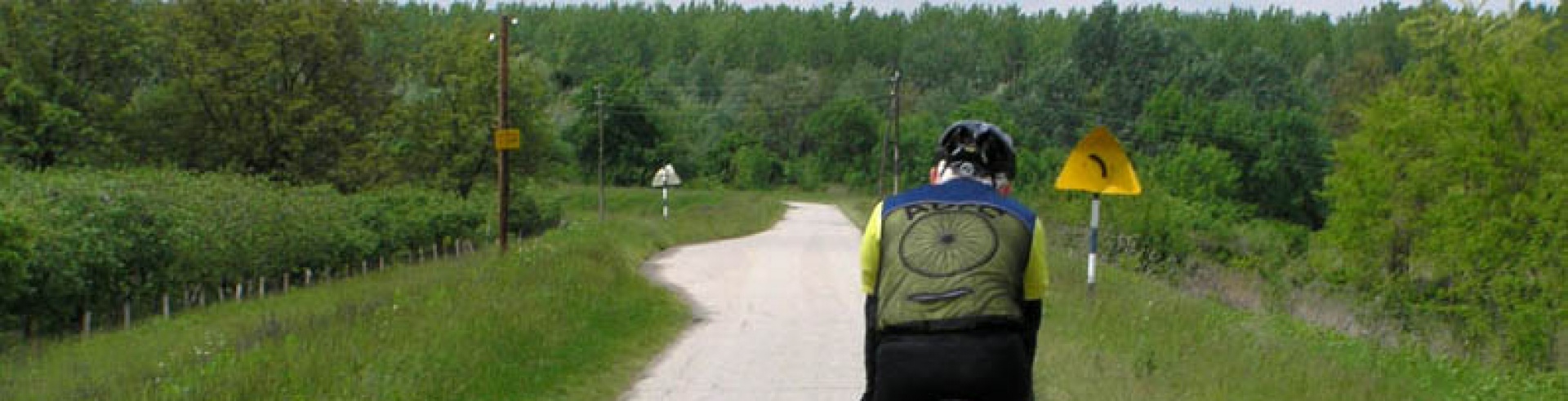
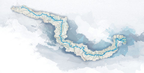
Cycling trail in Serbia, SECTION 1: Bački Breg (Hungarian border) - Sombor - Apatin
After you cross the border between Hungary and Serbia, near the little village of Backi Breg, you arrive in Serbia. Welcome! The part from the Hungarian border to Apatin and Backa Palanka is a mosaic of highways and country roads, hunting grounds and fens, remote places hidden in thick greenery, and...
City: Sombor
Country: Serbia
Cycling trail in Serbia, SECTION 1: Bački Breg (Hungarian border) - Sombor - Apatin
1. Bački Breg - Sombor (32km)
2. Sombor - Apatin (28km)
GPS track logs & waypoints for this base*
Section West: (Sections 1-4: Bački Breg - Apatin - Bačka Palanka - Novi Sad - Belgrade)
Section East: (Sections 5-7: Belgrade - Pančevo - Ram - Golubac - Đerdap - Kladovo - Negotin - Bregovo)
E - Food
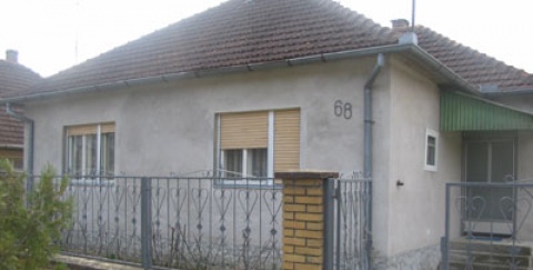
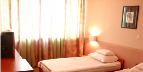
U - Sleeping accommodation
Note: Complete text and GPS marking was done by Ciklonaut Serbia, e-mail: jone@ciklonaut.com
After you cross the border between Hungary and Serbia, near the little village of Backi Breg, you arrive in Serbia. Welcome! The part from the Hungarian border to Apatin and Backa Palanka is a mosaic of highways and country roads, hunting grounds and fens, remote places hidden in thick greenery, and wide horizons. This is a region with hundreds of chardas – common fish restaurants where people often spend nights eating and drinking and listening to the traditional live music of the tambura-players (tambura = kind of mandolin).
Border: 0km
The traffic is rather light and the road is relatively good. At the end of the first kilometre we come to Backi Breg, and via the village of Kolut (4,5km), to Bezdan (9km). The name of this place means “without end” (Serbia: “bez dna”) and is due to a whirlpool which begins deep in the river near the bank, just a few kilometres away from our route. The river depth here reaches up to 30 – 40 meters.
In the centre of Bezdan we arrive at the junction R1 and there is also a petrol station. To continue the journey to Apatin you should turn left. We still recommend you not to stay on the main road but to enjoy a detour of Bezdan – the Danube riverside. Finally, if the day is drawing to its end, you can find some really nice sleeping accommodation.
On the 5km-long quiet asphalt road to the Danube riverside there is a great number of chardas and the surroundings are very pleasant, which are all preconditions for a comfortable ride. Circa 1,7km from the junction at the petrol station in Bezdan (R1) we will come across a side road on the left (Rd 1). Here you can choose to continue straight ahead or you can follow the side road which will take us to the weekend-colony Sebes Fok. At the beginning of Sebes Fok is charda Srecko (E, U). Later both roads reunite so we need not ride back if we take the side road through the weekend-colony.
If we stay on the main road we will reach Point Rd2, 3.8km away from the petrol station in Bezdan, where we can turn right to a road which leads us to the weekend-colony Kendija and the Eko ucionica (E, U). Eko Ucionica is in fact just another charda, but with a special atmosphere. In the forest on the bank of the old Baracka Creek (the water from the Creek gets into the Danube through the underground pipes) there are a couple of scrappy but nonetheless charming wooden cabins. In one of them is a charda and in the other one you get a room to spend the night. Everything is quite unique, one may say romantic. The hosts are hospitable, but only those who are not choosy will be satisfied with the accommodation: there is no running water or electricity, the rooms have improvised beds. Eko Ucionica will remain in good memory for all those who are looking for adventure.
Back on the main road: about 200 metres after the Point Rd2 we pass the Point Rd3 – a place where the main road and the road that leads through the weekend-colony meet.
After 4,4 kilometres away form Bezdan, we are crossing the junction Rd4, where we cycle straight ahead toward the riverside. This junction we should remember because on our way back we can turn for a detour and ride to Bezdan making a wonderful circle. This is also the place where the highway from Croatia joins, for everybody coming into Serbia from this country.
At the end of the fourth kilometre we come to the Danube riverside. The road that turns right will lead us to a pleasant weekend-colony Baracka where we will find a few more chardas (E, U) and therefore it is an excellent place to relax and spend the night. But we turn left if we wish to see the sluice for regulating the stage, which was designed by Gustave Eiffel, at the nearby estuary of the Big Canal into the Danube.
Until the stage of +600cm (Bezdan), or rather +680cm (Apatin) it is possible to reach all chardas in this area, with occasional exception of chardas Conta and Pikec. At the stage of +580cm the colony Baracka is closed and electricity is cut off. Averagely once in every 6 or 7 years the water level is high even in August. This is due to the snowmelt in the Alps. In autumn or winter the water level is low.
The area, in which we are now, was the arena for the Batina Battle, in which the Soviets and the Yugoslavs on the one side fought against the Germans on the other side in November 1944. The battle lasted 26 days and 40000 Russian and Yugoslav soldiers lost their lives. The monument built in memory of the battle we will see on the Croatian side of the river while the museum is on the Serbian side.
We can return to Bezdan using the same road. All those who do not mind a bumpy ride on a macadamized road, can turn left at the Point Rd4 and cycle back to Bezdan using a different road. Circa 400m after the junction we pass a turn-off to the nearby Batina Battle museum (on the right side) and after 800m we finally arrive to the Point Rd5 – a junction where you have to turn left to get to Bezdan. The asphalt ends a kilometre after the junction and we proceed on a macadamized country road that is in a very bad condition. But we only have to ride 2km on this road before we are back on an asphalt road. There is no problem using this road when the weather is fine.
About 300m after the beginning of the asphalt road we are at the Point Rd6, a junction where we have to continue straight ahead (left turn leads to the nearby beautiful weekend-colony Korlatos, but there are no chardas and no sleeping accommodation, but the short ride along the small houses clustered along a small road in the forest above the Feketeviz canal is very pleasant). More than a kilometre further we are back on the main road to Bezdan (Point Rd6). If we choose this return route to Bezdan, the entire detour will be about 11km long.
Why not continue down the Danube bank, straight to the village of Kupusina?
This 17km-long section is actually very interesting, it leads through the heart of Monostor Fen and you can say that this is the wildest part on the Serbian side of the Danube: if we pass this place at dusk or twilight, it is quite probable that we will have a close encounter with deer and does that cross the bank on their way from the forest to a water-place. But the road on the bank is earthy and in bad condition and almost the entire way we cycle through the large Monostor hunting ground. Therefore this is a big adventure only for those who do not mind bumpy rides and are accustomed to travelling through remote places. Annotation: It is possible that the hunting ground is closed during the rutting season from the end of August to the end of September (25.8. – 25.9.).
On this section is the weekend-colony Darazi Fok, for which there is a path 2,7km further on the right after the Point Rd4. This colony is on the Danube riverside and is some 100m away from the bank. If you go along the bank in the direction to Apatin, you arrive at another junction after 200m, which leads to this colony. In the colony there is no electricity or running water.
10,7km from Rd4 there is a junction from which you can continue straight ahead along the bank toward Apatin, or turn left to a macadamized road that leads to Backi Monostor (5km). If you turn right it will take you to the weekend-colony Dondo (1km). About a kilometre after the second turn (at 1420km the Danube flow) there is a place that is good for camping. (From this place you can see the river and cross to the nearby river island). The access to that place is possible if the water level is +100cm (measured in Bezdan).
Taking the turn right at the Point R1 in Bezdan we drive on to Backi Monostor. While we are still in Bezdan we pass the cross-way R2 (10km from the border), where the main road which leads to Sombor branches off. We will continue straight ahead down the road to Backi Monostor which has less traffic and it leads us closer to the Danube. The asphalt on this road is in good condition.
14,1km R3 – a triangular cross-way from where we ride straight ahead to a little bridge that is visible right after the junction. After we pass the bridge, we reach the forest which is also a hunting ground (deer). Driving through the shade of green trees some 500m further we pass the hunting house Štrbac (U), (which is on the right side of the road). We continue to the little bridge and over the Big Canal (15,3km), which is also the place where we leave the forest, that is, the hunting ground. The road between these two bridges is closed during the rutting season from the end of August to the end of September (usually 25.8 – 25.9).
16,6km Backi Monostor.
A big and pleasant village, which invites you to relax or have a longer holiday (there are several possibilities for accommodation, have a look at the sleeping-accommodation list). The asphalt from here to Sombor is at first of acceptable quality, and then gradually gets excellent.
25km
We pass a derelict but still very interesting building on the right side of the road. It is a former residence of the Juranovic family (Vamoser Salas).
29,3km
Junction R4, where we exit to the main road to Sombor and turn right. The city is not far away so we can expect heavier traffic, but within the normal limits.
30,2km
On the right side of the road a nice cycling path begins.
31,5km
In the street which leads to the centre of Sombor there is a bicycle store “Mexico” where you can buy spear parts or have your bicycle fixed (12. Vojvodanske udarne brigade No. 27).
32,1km
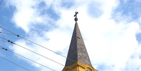
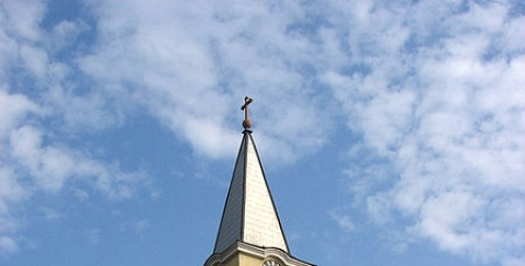
Sombor, centre. A beautiful old town full of adorable people, streets and facades, where the life runs in slow pace. The big cathedral-like building in the centre is a Carmelite monastery. Sombor was the place where the first cinema opened in the Balkans (1912); the first asphalted street in the Balkan was also in this town (1911, Parisian Street). Here there are endless possibilities for accommodation.
Sombor, centre: 0km
We cycle along the main road toward Apatin – on a section where traffic is heavy. At the exit from the town there is a pedestrian path on the left which we can use if we want a calm ride. Here we pass again the Big Canal. Considering that this canal meanders through this part of Vojvodina like a snake all the way to its mouth into the Danube near Bezdan, it is no wonder that the Canal is becoming more familiar to us than the distant and “reserved” Danube, during the first part of our trip through Serbia. But that will change fast!
Not too far away before the crossing of the Canal, there is a sideway on the left that leads to charda Andric (700m), a place which you should not miss visiting because of its very convenient ambiance and its excellent cuisine (the delicacy: paprikasch, which is prepared with deep respect and strict ritual).
6,6km Junction R5.
Here we leave the main road that leads to Apatin and turn right toward the village of Kupusina. The traffic will be light from now on; the asphalt on the road is of solid and good quality.
10,1km Kupusina, R6.
On the left side of the junction there is a petrol station and on the right side is a transformer of a power station. We turn right.
12,7km
We come to a bank of Danube-Tisa-Danube Canal. The asphalt road here leads us to the right and after about a kilometre we go across the Canal. At this place there is a building with the Canal watergate and directly behind it is the Point Rd7 – here we recommend the detour No.2 to charda Štuka (U). Considering the fact that the entire detour involves earthy roads, good weather is required.
Rd7 - 0km
From the sluice we cycle on down an earthy road, which goes along the Canal waterside.
0,2km
We pass Rd8 where are huge forest road parts on the left and backwards, but we continue straight ahead.
~0,4km
Rd9 – the place where we leave the road that goes along the Canal and turn left to a path which leads into the forest. We immerge in a magical green world where silence is only highlighted by songs of birds that we will enjoy while the tight road leads us through a picturesque play of light and shadow under high tree tops.
1km
Rd10 – we move on straight ahead passing a bigger forest road.
1,4km
Rd11 – we move on straight ahead passing another big forest road. There are noticeable path signs (have a look at the photo on the right), which should make our navigation easy.
1,8km
Rd12 – here we turn left.
2,1km
Charda Štuka (U). A place, hidden in Amazon-like greenery, on the waterside of Monostorski Dunavac Canal, is a secret of the local fishermen. On the clearing covered with sand there are tables and chairs from forged iron – an allusion to the Parisian cafés. The canal actually represents the old Danube flow, which became backwater when the river was rerouted in 1975 near Apatin.
Here we can also spend the night for a really low price and we can also rent a boat. But considering that only the basic needs are fulfilled here (no electricity, field-WC, water from a well, improvised showers from a barrel in the yard) this is a place only for those who do not mind such Robinson Crusoe-like conditions.
In the charda you can order a drink (prices are low: beer is 25 Dinar, coffee 15 Dinar...) and although meals are prepared only out of groceries that guests bring with them, most likely you will be able to arrange to have a nice piece of fresh fish that one of the fishermen has caught. You can reach the charda during the entire year regardless of the water level because it is on the “dry” side of the bank protected by levee. At the end of winter and in spring (February-March) the water level at this part of the Danube is raised and controlled for the fish spawning. We return the same way we came.
To get to Apatin we continue straight ahead from sluice, following an asphalt road. A nice part of the road lays ahead down which we will ride on a peaceful bank of Kupusinski and Monostorski Dunavac Canals, through lush greenery of the trees and grasslands. There is almost no traffic, the asphalt is of good quality, and so all conditions are there to enjoy a calm and smooth ride and also engage into light conversation with our travel passengers. We pass the charda Pcela (right side, beneath the road).
This pleasant place in the middle of the grassland,next to the Canal, is convenient for a little rest or lunch. The charda Brunai (17,8km) is also similar to this one.
19,5km
R7 – to get to Apatin, you continue straight ahead.
And if we feel like swimming, we can turn right at the Point R7 to a kilometre remote beach in the weekend-colony “Vagoni”.
That be the case, after 400m we will turn left on the next junction to the colony. At this junction straight ahead of us is a chain-link gate of a hunting ground where the asphalt road on the bank ends. During the hunting season the gate is closed but, as already said, we turn left here and descend from the bank down the road that leads us to the river. The first 50m of the road are asphalted, after that the road is macadamized.
After another 400m we should turn right to the beach, which you can already see from this point. The beach is not especially cultivated but it is sandy and very nice. In this colony is also charda Vagoni (E, U).
From the colony a national park begins which is of special importance to the ecological system of Gornje Podunavlje (1403 – 1433km of the Danube). This national park is of the first category.
Continuing our journey to Apatin we finally cycle along the Danube. That bank road is still very calm and of good quality.
21,3km
Rd13 – here we can leave the asphalt road on the bank and embark on a journey down the little curvy field roads, which also lead us to Apatin (Detour No.3: little Apatin circle). But in case we are not in the mood for something like this, we can continue cycling along the asphalt road on the bank.
21,7km
We pass charda Harcas (E, U) (on the left side, near to our road) and right after that we pass a little turnoff, which leads to a nice secluded sandy beach on the right side of the Danube. The beach is some 500m away and you have to go through a forest. When the water level rises (mostly in spring) the road to the beach is flooded. Harcas creek is one of the biggest spawning places on the whole Danube especially for pikes and catfish (“harca” is the Hungarian word for pike).
Since this entire detour is mainly on earthy roads, we recommend it only when the weather is dry.
Rd13 – 0km
After leaving the bank, we follow the earthy country road.
2,2km
We come to a wider and better road. Here we turn right and follow this road.
3,0km
Crossing Mirni Dunav Canal (quiet Danube).
4,4km
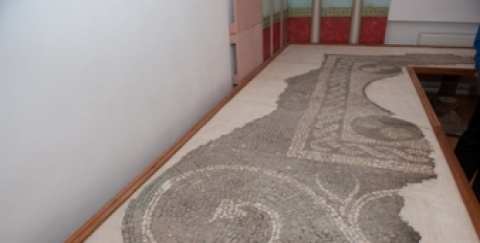
Hermina Marsh. This area is pleasant; the lush greenery completes the experience. The Marsh is more than 30m deep and is a part of the old Danube. This is why in the ancient times the border between the Roman Empire (left) and the Sarmatic Kingdom (right) was here. The evidence for this is the higher ground which we will notice in the fields on the right, where an (unorganized) archaeological location that testifies about this part of history, stands; the only ancient figure found in Backa, comes from this place. Even today there are tracks of the Roman redoubt, that lead to Novi Sad. (We will find them if go to the house visible in the field). People believe that the redoubt was actually built by the Sarmatians to protect themselves against the Romans, but in history the name Ager (redoubt) Roman Ancient remains.
On the same place, which is today a farmland, there was the city Aranjos, first mentioned in the 11th century and from which, later on in history, became the Serbian settlement Vranjesevo. In the 18th century convicts dragged ships from the waterside upriver, and, like stories go, Hermina marsh was actually in former times, when it was still a part of the Danube, a very powerful and very dangerous whirlpool where great number of ships sank.
Later on, this moody river decided to take a new flow and leave Hermina and its legends on a ”dry land”, so that the workers on the homesteads could retell these legends on long winter evenings.
6,2km
We are crossing the railway tracks and arrive in Apatin.
23,6km
Rd14 – to get to Apatin we continue straight ahead. But at this point we can turn left from bank to a circa 500m far away lodge in which are the remains of an old steam pump from 1887. The pump regulated the water level in Mirni Dunav Canal (once the Danube main stream was here, so Kupusina and Monostor were on the waterside 200 years ago).
24,5km
On the left side beneath the road is a resting place Boja (U, E) and some 100 meter ahead on the right is a motel Rebraca (E, U) whose owner is the famous MBA basketball player Zeljko Rebraca. On the riverside near the motel is a beautiful beach (you can see it from the road).
25,6km
R8 – if you turn right here you get to the local shipyard but we continue straight ahead. This part of the road is macadamized. 26,1km R9 – on the left side of the road is the football pitch of the sports centre “Rade Svilar”. The bank road goes straight ahead. Since this area here looks more and more industrial, it is better for us to turn left here onto a nice and asphalt walking path, which goes along the football pitch, crosses railway tracks after 300 metres and leads us straight to the first street in Apatin. It does not take long to cross the tracks but it not the most convenient way (loaded bicycles have to be pushed across the tracks). Therefore if you want to avoid this little inconvenience, you can use the bank-road.
27,5km
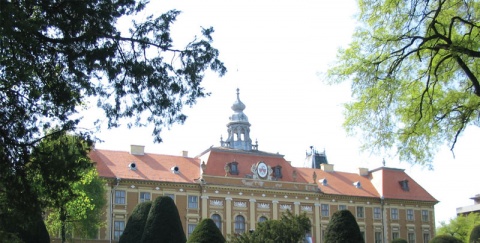
Apatin, centre. A beautiful little town which founders were German colonists and which has kept its special flair. This city was named after the abbey which was once here (Opatija - Apatin). -- Accommodation options are numerous, have a look at the sleeping-accommodation-list. There are two bicycle stores where you can have your bicycle fixed as well. Besides the old churches, a new orthodox church of the Holy Apostles was built in the town. This church is located in the pedestrian area on the riverside, near charda Zlatna Kruna (U). In any case, you should visit the pedestrian area because of the beautiful sight on the river, which here makes a large and wide meander , decorateed by the splendid green riverside.
*Remarks:
1. Regarding waypoint you are interested in always check in your GPS the field with its additional description: there you can find full name of the waypoint as well as various additional information.
2. Waypoint system is designed to show direction down the river; for example waypoint “asphalt start” means the asphalt starts at that point when you have in mind defined direction – if you travel up the river stream this would then be the place where asphalt ends.
3. Situation at the field continuously changes, therefore GPS data here given can be changed or updated – that is why we recommend that you download the data from the web site right before the planned journey.
4. If you find some inaccuracies or you wish to add some new GPS data you find important, please inform us using this address.
Explanations for abbreviations used in waypoint denotations:
• Number without any letters: number of the crossroad at the main route (corresponding to the number on the map and number on the sign-post at the field)
• Alt + number: number of the crossroad at alternative route (corresponding to the number on the map and number of the sign-post at the field)
• D + number: number of the crossroad at detour
• S: turning point
• Vo: water (spring, drink-fountain etc.)
• asf st: beginning of the asphalt road
• asf end: end of the asphalt road
• cycl: bicycle parts selling store and/or bicycle service and/or bicycle center
• Muz: museum
• Ht: hotel
• Mot: motel
• P: pension
• car: čarda (fish restaurant)
• kaf: tavern
• T: tunnel
• Names of inhabited posts are written with capital letters
DANUBE.TRAVEL has no control over the website content generated by users and/or visitors, neither such content represents a statement, opinion, recommendation or rating by DANUBE.TRAVEL. For further information please refer to DANUBE.TRAVEL – General Website Terms and Conditions of Use.
Places near this location
Where to stay

What to do

Danube experience