Trescovat – DN 57
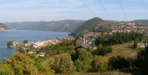
The passage to the volcanic neck Trescovat is located within the Iron Gates Natural Park, Almajului Mountains begins at approximately 5 km upstream from the town Svinita Danube Valley. Entrance route - red triangle - is made from DN 57 (Orsova - Moldova Noua) and is signaled by a panel that provides...
City: Orsova
Country: Romania
Trescovat – DN 57
The route is easy and starts with a slow climb, surpassing some of the local farms. It goes on a forest road that is part of a valley and gradually climbs to the tops of hills. After about 30 minutes we reach a small promontory where we have a better picture to crown the first Trescovatului but also to the Danube.
Further follow the marks all the road. The climb gets worse for some parts and go out after about 20 minutes in a clearing. You can shorten the route, keeping up the forest road while marking down the meadow, making a wide detour.
The climb through the forest takes us out pretty quickly in a large meadow with a house and orchard. Overcome the house, crossed the orchard, looking to the right and markon the trees. We enroll on a coun quite wild, passing, at the forest edge, including another house and a shed of beams. From here the path goes right and after about 5 minutes we get another great lookout point to Trescovat.
Planted in this place find, strangely, the pillar that marks' end Trescovat tourist route ".
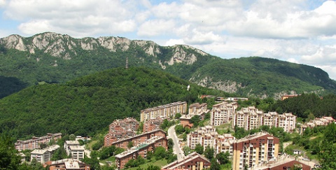
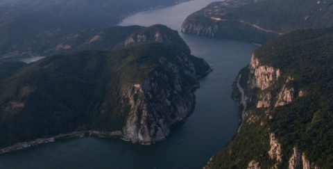
Volcanic neck is almost entirely visible here. It separates us from a deep valley which rises, vertical, steep, rocky buttresses tip. Slopes of tens or hundreds of meters, towers, ruins, grow and tanks, so it shows the entire southern front Trescovatului dominated chromatic shades of red and yellow contrasting with the green forest.
The trail continues on the edge, bypassing a large covered valley and continue climbing. Initially wider and somewhat frail then, crossing the grassy sections, covering her attention we request to track marking which change direction several times. Above, cross a small clearing and then after entering the forest, something more sustained climb, the trail is more unclear. Crossing a swampy area and a short climb in a few tens of meters, the saddle behind Trescovatului.
A short branch, quite steep, we climb the coast in 10 to 15 minutes even on top, above the bare tank to over 200 m level difference from surrounding areas and more than 400 m from the Danube.
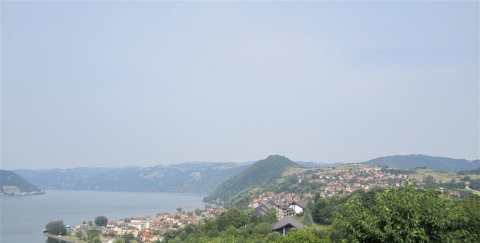
Landscape opens wide the river. Danube is visible for miles both upstream and downstream to. Facing rising mountains of Serbia and wooded shorter. The side we can see a part of Almajului Mountains, forested.
Way back may be shared with the access or can continue on the same mark, but in the way we conduct nationwide by about 3 km upstream from the starting point. The route is recommended for all categories of tourists.
DANUBE.TRAVEL has no control over the website content generated by users and/or visitors, neither such content represents a statement, opinion, recommendation or rating by DANUBE.TRAVEL. For further information please refer to DANUBE.TRAVEL – General Website Terms and Conditions of Use.
Places near this location
Where to stay
The rooms for rent - in the house of Slobodan Velic
The rooms for rent - in the house of Slobodan Veli...
The rooms for rent – in the house of Ivan Jonovic
The rooms for rent – in the house of Ivan Jonovi...
 EN
EN DE
DE
