EN
EN DE
DE
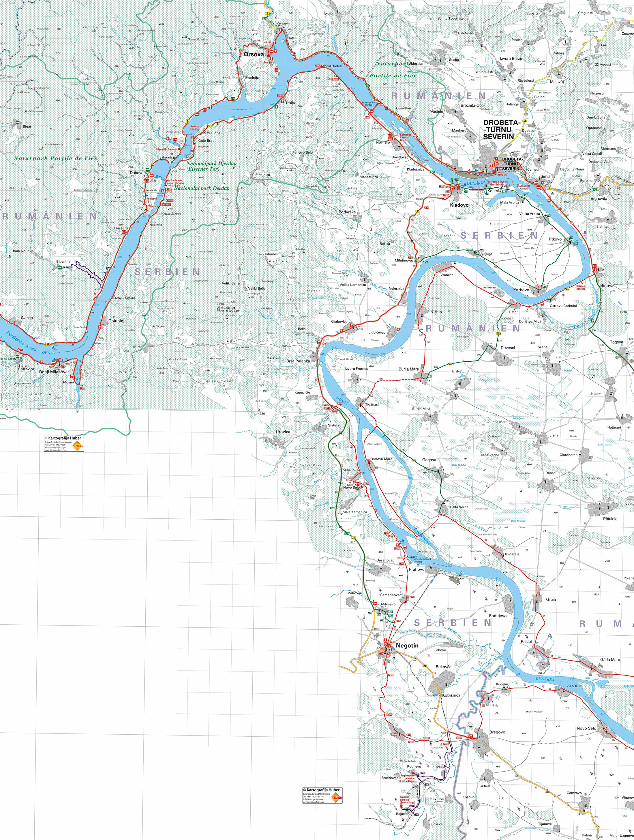
Cycling trail in Serbia, SECTION 7: D. Milanovac - Kladovo - Negotin - Bregovo (Bulg. border)
At the exit from Donji Milanovac we are entering the main road to Kladovo......
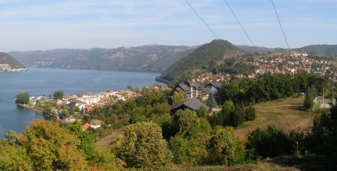
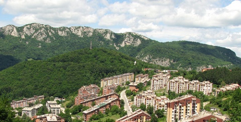
City: Donji Milanovac
Country: Serbia
Cycling trail in Serbia, SECTION 7: D. Milanovac - Kladovo - Negotin - Bregovo (Bulg. border)
Section 7:
D. Milanovac – Kladovo – Negotin – Bregovo (Bulgarian border) (132km)
1. Donji Milanovac – Kladovo (63km)
2. Kladovo – Negotin – border (69km)
• Map (2,487Kb)
GPS track logs & waypoints for this base *
Section West: (Sections 1- 4: Backi Breg - Apatin - Backa Palanka - Novi Sad - Belgrade)
Section East: (Sections 5-7: Belgrade - Pancevo - Ram - Golubac - Đerdap - Kladovo - Negotin - Bregovo)
E – Food
U – Sleeping accommodation
Note: Complete text and GPS marking was done by Ciklonaut Serbia, e-mail: jone@ciklonaut.com
Donji Milanovac, centre: 0km
0,4km
R111 – at the exit from Donji Milanovac we are entering the main road to Kladovo.
1,8km
Mouth of the river Porecer. The road does not lead directly to the other side, but goes up the river; only after more than 2 km we will cross the river and come back to the Danube. A nice chance to enjoy beautiful scenery around the mouth which is a resting place for numerous marsh-like birds.
4,6km
R112R112 – there is a crossroad right after the end of the bridge which we used to cross to the other side of the Porecer River. On the right there is a road to Bor but we will turn left thus coming back to the Danube riverside.
6,3km
R113 – on the right uphill there is an asphalted road towards the village of Miroc; we will continue straight. All the way to Kladovo we will drive beneath the mountain which bears the same name, the Serbian Polynesia, where, similar to islands, people live on scattered and remoted homesteads, separated by a huge green jungle. Up there live people, similar to the ones in Polynesia, who, due to their long isolation, do not care about passing of the time and history and are not eager to hear news. You can notice the same trait among seven different nations living here: Serbs, Vlahs, Romanians, Montenegrins from Petrovo Selo (where the king Peter brought them and they still cherish their language, traditional costumes and customs of their ancestors), Germans, Jews, Romas…and who knows, perhaps even a Japanese who still doesn’t know that the Second World War is over.
7,3km
We are back to the Danube riverside. The traffic has been low till here, but now it seems there is almost no traffic: sometimes it takes minutes to see a car on the road.
10,6km
The restaurant Dunavska koliba (the Danube lodge) (E) on the left. There is a tap in front of the restaurant.
11,0km
The village of Golubinje.
18,7km
We are driving on a bit deteriorated asphalted section (patched), but the road is generally good.
21,0km
Entry into the longest tunnel T04 on the Danube highway (371m). The backlight and headlight on the bicycle are necessary again.
22,0km
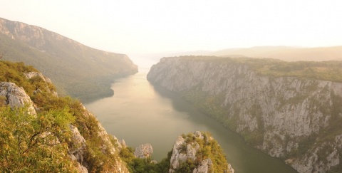
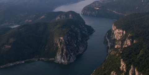
We come closer to the most beautiful part on our journey through Serbia: the passage between Mali and Veliki Kazan (Small and big Tank), the narrowest part of the Straits of Derdap. At this place we can see the first part of the stone lock of the former Gate of Europe. ‘Kazan’ is the word of Turkish origin and it describes a pot in which fluid boils: before the erection of the Djerdap Dam, ships were passing this jaw-like area with the help of local guides, the so-called pilots, who knew every whirl in the 200m wide river and thus furious like a wild beast captured in the cage.
23,1km
A cultivated spring on our right. If our mouths get dry because of the excitement, we will have a chance to get some refreshments. We are beneath Veliki Strbac (768m), the highest top of Miroc and at the entrance of Mali Kazan.
25,0km
Entry in the tunnel T03, the second longest on the Danube magistrale (285m).
25,6km
We pass through Mali Kazan. The walls and towers of this stone cathedral are about 300m high and the width of its water bottom is less than two hundred metres.
25,9km
Painter’s shop and gallery Pena (only opened for expected visitors).
26,2km
A huge white ball at our left side – an artefact of the gallery. The wider section between Mali Kazan and Veliki Kazan (deep bay in front of the Romanian village of Dubovo, on the other side of the river) gives us opportunity to take a deep breath before we dive into the second part which forms a scar on the earth’s surface through which Pannonic sea once flowed.
26,8km
The restaurant Balon Varnica (E). A perfect position with a perfect view. The restaurant is at the former station – the “river traffic light”. During the time before the Djerdap Dam, there wasn’t enough space in Veliki Kazan for two ships to pass at the same time. Therefore, there was a metal bar with a big aluminium ball giving directions to skippers whether they can pass through Veliki Kazan or they should wait for another ship to get through. We can still see this metal bar from the restaurant’s terrace.
We drive through a short tunnel 102 which is behind the restaurant and we enter Veliki Kazan. This is where the Danube is at its deepest- some of the whirls are over 80m deep (one of the biggest rivers depths in the world), so its basins are below the sea level.
28,2km
Entry in the tunnel T01, the last tunnel on the highway. The exit from the tunnel represents the end of Veliki Kazan.
29,3km (150m above the sea level)
On the left there is an earthy road towards the meadow called Hajducka vodenica.
You can get there after some hundred metres, after a steep downhill through the forest. The meadow is a nice place for wild camping (take water with you) or to have a break and it is very popular among the Danube-sailors – in summer you will surely see at least one anchored boat.
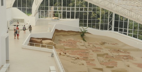
Behind this turning there is the second and the last rise on the Danube highway (the first one was up the hill Boljetinsko brdo, behind the museum Lepenski Vir). This time we will climb up the hill Golo brdo, even higher than 275m. At the beginning of the rise our attention will be drawn to a huge stone portrait chiselled in the cliff at the opposite riverside. This cliff is Romanian Mount Rushmore and the portrait represents Decebalus, the last king of Dacians who were ancestors of the today’s Romanians. Decebalus was defeated in the 1st century by the Roman emperor Trajan and this defeat for Romanians means the beginning of the long lasting life under the foreign rule. Symbolically, the portrait is almost opposite the ‘Board of Trajan’ on the Serbian side.
30,8km (215m above the sea level)
A place, where you have a magnificent view of Kazan. Later in the afternoon you can see a magic play of water, rocks and the sky. As the day is coming to an end, the light falls to the river-mirror at an optimal angle, so you can notice the blue colour from its depths.
32,0km (275m above the sea level)
Golo Brdo, end of the rise which was 3km long. Prize: 5km long downhill.
Directly before that place you can see an inconspicuous sign on our left, marking the beginning of a pathway, which should lead to the “Board of Trajan”. But the board is on the cliff, directly over the river while the pathway ends and leaves us in very thick greenery, high up on the edge of the cliff. In other words: this precious monument is only accessible from the water.
“Trajan-Street” and “Board of Trajan” (“Tabula Traiana”)
The Roman emperors Tiberius, Claudius, Domitian and Trajan had been settling the natural border during the 1st and 2nd century AD which was, at that time, the Danube to the barbarian Europe.
As part of these endeavours, a road from Golubac to Kladovo was built in the steep rocks of the Straits of Djerdap. This road was later used by the Latin legions on their way to conquest the land of Dacians. The Board of Trajan attests to the construction of the road and the bridge nearby Kladovo- it is a huge marble bloc which was placed on the rock high above the road in the year of 103 with the emperor’s words announcing: “Having beaten the mountains and the river, I have built this road”. The inscription, 4 out of 6 lines are preserved, has the dimension of 3,2x 1,8m and is carried by two chiselled winged geniuses. Above it there is a canopy with decorated rosettas and above that all is an eagle with wings wide spread. Because of the rise of the Danube level and during the construction of the hydroelectric plant Djerdap, the Board and the rock were displaced to a higher level.
Until the water level rose you could see the holes in the rocks of Kazan: where horizontal rafters used to be placed- the road carriers. That is how the rocks in the cliff were surmounted.
Here we can climb up a high rock on our left and with cameras in our hands we lurk for other group members- it is going to be a wonderful picture with the cyclists on the road through the rocky area descending into the blue Danube.
37,1km (90m above the sea level)
End of the downhill ride.
39,7km
The restaurant Panorama (E) at the entry to the village of Tekija, right above the road. The terrace with the beautiful view justifies the name.
40,2km
The restaurant Plaza (“beach”) (E). Close to that is the beach (you should not expect an arranged beach, but it can serve the purpose).
40,5km
Tekija, centre. (Tekija is an Arabic word and stands for a Muslim pray house where dervishes hold their masses) It is one of the places which was displaced because of the formation of the artificial lake for accumulating water: the inhabitants love to talk about the times, when the water level is low and they go down to see the remains of their houses. Every august the Danube fishermen meet for some days, have fun and go fishing for catfish. With the time, this gathering of fishermen, called “Tekijska bucka” (“churn”- a thing which makes the churning sound to make catfish come to the surface) has grown into a festivity with folk music and full board for inspired visitors.
42,2km
On our left there is a monument dedicated to Captain Koca Andjelkovic and his companions who were killed at this place by the Turks in 1788. A little further, on the Romanian side a big bay of the river Cerna begins and on the surrounded hills lies the beautiful city of Orsava. There is a legendary island Ada Kale hidden in this bay which was, in former times, visited by the Argonauts and where a Turkish colony used to be in a city which architecture resembled the one from the heart of Turkey. (The parts of the city were brought to a museum of Romanian island of Simian nearby Turnu Severina).
53,2km
R114 – on the left there is a road leading to the hydroelectric plant Djerdap and to the border with Romania, we continue straight towards Kladovo. Here is worth asking around, if we are lucky enough we can join a group of tourist on their tour around the Plant.
Note for all those who want to cross the border with Romania: the border passing at the Plant is officially allowed only for motorized vehicles but neither for pedestrians nor cyclists. In practise, this rule is for local people only, whereas the cyclists may cross the border here. However, if it happens that you are not allowed to cross the border (which is very unlikely), you can easily solve the problem by asking someone to give you a ride to the other side.
55,0km
On the right side there is an entry to the Sport Club Karatas (E,U). Regardless of the name, you can sleep here in bungalows because there is no official camping site. However, if you ask at the manager’s office ( it is in the 300m distant bungalow in the middle of the camp, on the left side), you will surely get a permission to pitch a tent. There is a beautiful place for that, behind the office, on the meadow close to the basketball ground. There is also a wooden marquee with a table and benches.
55,3km
A road turns left to the escavation site Diana.
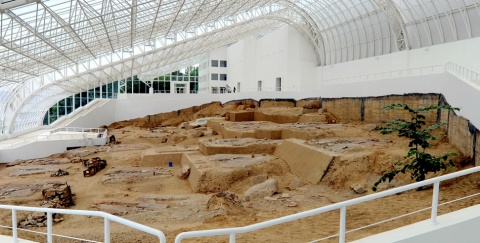
The castrum Diana
These are the remains of one of the biggest castles (army encampment) from the Roman and early Byzantine period, which was built during the reign of the emperor Trajan at the end of the 1st century. The castle was built to protect the canal and made the traffic on the Danube possible. It comprised of the fortress with the civil settlement and a necropolis. On the border with, what the Romans used to consider the Barbaric Europe, Diana was one of the last important strongholds in line with Lederata (Ram)- Suppae (Golubac)- Novae (Cezava) and Taliata ( Veliki Gradac which is Gornji Milanovac today). The fortress was partly burned during the attacks of the Goths in 378 and devastated again in the invasion of the Huns in 443. It was rebuilt by the emperor Justinian at the beginning of the 6th century and completely destroyed during the invasion of the Avars and the Slovenians in 596.
Today at this excavation site one can see walls from different type of bricks and stones and the remains of the square towers with round corners. The bronze statues and other objects that were found here are kept in national museums in Belgrade and Negotin.
During the archaeological excavations another “Board of Traian” was found there; now it is kept in the managing office in the Hydro electrical Plant of Derdap. You do not need a ticket to walk around, but there is neither a guide – you can only see couple of boards with the map of the fortress and a short text in Serbian and English.
55,9km
We pass the village Sip (left side).
56,5km
R115 – turning left you get to a side road leading to the villages Davidovac and Kladusnica. This road first leads to the riverside, then down the river, parallel to the main road. But because this road is really bad and the traffic on the major road is not so much intense, we will continue our drive.
On our way to Kladovo the Danube will talk to us exuberantly how he was tortured behind us, and how he was forced to flow through a narrow metal passage, then through some dark concrete tunnels. We better not tell him that the Djerdap Dam is awaiting for him.
59,0km
R116 – on the left side the major road connects the above mentioned road via Davidovac and Kladusnica
62,0km
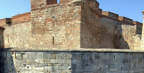
A road turns left to the nearby fortress Fetislam.
The fortress Fetislam It is assumed that the first colony had been developed during the Roman invasion of Dacia (nowadays Romania). The oldest preserved part (the so-called “little city”) most probably is the remains of the fortress of Trajan which was rebuild during the 6th century by the emperor Justinian. In the 11th century the colony is known as Novigrad. During the middle ages on the Roman foundations the Turks built the fortified city Fetislam with more than 5 hectres. Most intensive construction works were in 1542, when the sultan Suleyman the Magnificent prepared the fortress for the impending attack against Turnu Severin. In 1867 the Turks handed over Fetislam to the Serbs.
62,5km
R117 – The crossroad at the entry to Kladovo. The centre is straight ahead and we turn right to get to Negotin.
Kladovo attracts attention with its nice atmosphere and an amazing, slow living rhythm during summer afternoons. A card thrown casually on the table, a glass of beer waiting to get empty (we are in no hurry), the sleepy-like squeaking of the prams, a hat on the back of the head while the shadow is on the forehead. Ribbons on the heads, sometimes on the neck, hardly say hello when they pass some familiar ribbon or a scarf. Slow steps passing by quietly as not to disturb the river which only has the right to lie in the sun and to swing the ships which are lazily positioned in the shipyard of Severin. A long beach full of cheerful swimmers overlooking Turnu Severin, while the main road ends with the line of old trees, the so-called green tunnel through the hot air.
When the night falls on such places, one gets the impression as if one were at the sea; then the nightlife begins with long walks, dinners, vines, white trousers, tanned faces, dancing music on hotel terraces, sitting on the walls and mutually searching for souls that begin to like one another during the day on the beach.
If we want to drive along the Danube riverside as long as possible and if we like the thought of our visit to the remains of a legendary structure such as Trajan’s bridge, this will be the right choice. It is a tarmac road, which means we can drive on it during all kind of weather, but the quality of the road is mediocre.
R117: 0km
In this case we will turn left at R117 and pass by the city museum.
0,1km
We will turn to the first street on the right, parallel to the riverside.
0,46km
We arrive at the crossroad by a huge hotel Djerdap (E,U) which is on our left( it is the tallest building in Kladovo). On that side a promenade begins whereas on the right side of the crossroad is the café Vanja (E) (actually it is a pizza place with a nice garden surrounded by creepers). We will drive straight ahead from here and get to the gateway from Kladovo.
2,0km
The hotel Plaza (beach) (E, U).
3,2km
The village Kostol.
4,7km
On the left there is a road leading to the 550m distant remains of a high oval pillar, a part of the famous Trajan’s bridge which was built according to the project by Apollodor of Damascus. The construction works were finished in 105, it was 1127m long and it had 20 pillars with 38m distance between vaults. However, the bridge did not remain for a long time- it was destroyed during the rule of Trajain’s successor Hadrian.
6,7km
The village Mala Vrbica.
9,6km
The village Velika Vrbica.
12,9km
Ra25 – a crossroad in the centre of the village Rtkovo. To get to Negotin we have to turn right here. (There is a marker at the crossroad.)
18,6km
The village Korbovo.
25,3km
The village Vajuga.
30,5km
The village Milutinovac.
31,3km
R120 – exit to the main road to Negotin, where we have to turn left.
On our way from Kladovo to Negotin the road is good. The traffic gradually gets more and more intense as we leave Kladovo but it is still tolerable. The area is mountainous, so we should expect two rises of about 3km long. The area we are driving through is not as beautiful as the Straits of Djerdap, so we might lack inspiration. In any case, if not inspiring, this part of the road is very pleasant.
63,5km (46m above the sea level)
Directly as we exit Kladovo a rise begins which will be 3km long with an altitude difference of 104m.
66,7km (150m above the sea level)
R118 – on the right there is a road to Petrovo selo but we drive straight ahead. At this place the rise ends.
69,2km
R119 – a road turns semi-right to the village of Recica (little river) but we will turn semi-left.
72,7km
R120 – a crossroad near the village of Milutinovac at which, from the left side starts an alternative road via Rtkovo and Korbovo. We will continue straight.
76,4km
The village Velesnica.
79,2km
R121 – a road turns left to the village Ljubicevo; we move on straight ahead.
81,3km
R122 – a road turns right to the village Veliki Kamenica; but we drive straight ahead.
82,1km
The village Grabovica, centre. Near the village there are taverns Zlatibor,Stari Gaj and Kum. In front of the tavern Kum there is a tap and a store.
84,8km
R123 – second turning to Petrovo selo (right). We drive straight ahead.
85,6km
Brza Palanka, restaurant Egeta. There are a store and a post office nearby and across the restaurant there is a meadow suitable for wild camping. Some 200m further there is a restaurant Gurman.
There is a nice gravel beach with shade. There is a tap on the beach and camping is not allowed.
86,5km
R124- on the left there is a side road towards the mountain Miroc, we will continue straight.
87,1km
Brza Palanka. It is a calm place with lots of weekend houses. It makes us think where we should live when we retire. If we are already retired it will make us think why we don’t live where we have always planned.
If a very low traffic on the old road is of the key importance, we can also cycle that road. In this case we will turn left at R124.
R124: 0km
2,6km
Ra26 – on the right is a juncture to the main road (the Point R125). We continue straight ahead.
4,1km
Ra27 – on the right there is another juncture to the main road but we again continue straight ahead and cross a little bridge over the Slatin River. A bit further on, this little river flows into the Danube creating sandy and muddy sediments at the mouth.
11,4km
The village of Mihajlovac. On the opposite riverside that looks close is actually the riverside of a big Romanian island, on which the village of Ostrovo Mare is (we can see it from the road).
12,8km
Ra28 – in the village of Novo Selo a road parts on the right to the village of Mala Kamenica; we ride straight ahead.
20,2km
Ra29 – if you turn half-left the road will lead you to the village of Kusjak, but we will turn half-right to the village of Samarinovac.
22,8km
Ra30 –from the left and from behind is the road that leads to the village of Kusjak; we continue straight ahead.
23,8km
Ra31 – a road parts on the right to the village of Dusanovac, but we continue straight ahead.
25,1km
Ra32 – A junction in Samarinovac. A road turns left to Prahovo but we continue straight ahead.
30,4km
Negotin, centre.
90,5km
R125 – on the right is a road to the village of Kupuziste parts, and on the left is a juncture with the old road (Point Ra26). We continue straight ahead.
92,0km (55m the sea level)
R126 – a road parts on the right to the villages of Slatina and Urovica. We cycle straight ahead down the main road. We immediately cross over the Slatiner River, where the second steep rise on the section Kladovo – Negotin begins. It is a bit longer than 3km and there is an altitude alteration of 80m.
Relatively close to the road on which we ride on is an important natural rarity – big natural stone gates (overhangs) in the canyon of the little river Vratna. These formations created by water that during thousands of years drilled holes in stones and made stone “bridges” among which the highest is 80m. So, there is a strong motive for a visit, one should also add to it the beauty of the canyon itself and its surroundings.
The area is hilly. First the road rises through the valley of the Slatin River and the rivulet Vratna to monastery Vratna. As the road continues, there are two considerable rises that need to be conquered before the village of Jabukovac. One is about 2km long the other 5km.
R126: 0km
7,5km
A junction in the centre of the village of Urovica. Here we turn left ( to the south).
11,2km
At this junction you can go straight ahead to the village of Jabukovac, Stubnik and Negotin, but we will turn half-right to get to monastery Vratna.
12,0km
The village of Vratna, centre.
15,2km
On our right is the building of the former alpinist home (today it is a half-closed resting house). Here ends the asphalt and we ride on solid macadam.
16,1km
Monastery Vratna (155m above the sea level). After the monastery estate, we pass a moufflon-breeding farm. There is a great chance that we will see these beautiful animals and be able to get close to them about 100m– if nothing else, this is something worth seeing. From the monastery we follow a clearly visible pedestrian path (we leave the bicycles at the monastery) to the first stone bridge, which is about 300m away. We can either go beneath the bridge or easily climb on it – the view from the bridge is amazing. You can also reach the other bridge easily, while if you want to get to the others, it will cost you a great deal of time and effort. But the first two bridges are the most attractive, so they should be enough to fulfil our day.
If it is necessary, we can camp near the monastery (ask for a permission) or in the canyon, under one of the bridges (magic atmosphere, the night spent here will be unforgettable for sure). If we decide to do something like this, we should make sure that we do not leave garbage behind – the beauty round us is fragile and can be easily disturbed.
We return the same way to the junction Vratna – Jabukovac – Stubik.
21,1km
We are again at the junction Vratna – Jabukovac – Stubik (105m above the sea level). This time we will turn right to Jabukovac. About 400m further a steep rise on Dubrava hill begins.
22,9km (193m above the sea level)
The rise ends. An easy downhill-ride begins directly to Jabukovac.
24,6km
The village of Jabukovac, centre (175m above the sea level). We turn left here toward Stubik.
24,9km
The second junction in Jabukovac (165m). We turn left again and leave the road to Stubik and cycle to the village of Dupljane.
26,4km
The third junction in Jabukovac. On the right there is a minor street but we ride straight ahead (to south-east). After a short rise to 185m above the sea level, we cycle downhill to the rivulet Zamna.
27,6km
We cross the Zamna (114m above the sea level) and on the other side of the river a 5k-long steep rise begins (the last kilometre is not so intensive).
32,5km
End of the rise (325m above the sea level). We ride downhill to the village of Dupljane.
35,1km
Dupljane, centre (193m above the sea level). Behind the village we continue to spend the hard-earned height by riding slowly downhill to the small valley of Dupljan Rivulet.
38,5km
A junction (95m above the sea level), where we continue straight ahead toward the main road (in the direction of the village of Dusanovac).
39,4km
R130 – we come to the main road and turn right, toward Negotin.
95,1km (135m)
End of the rise.
96,3km
R127 – another road turns right to the village of Slatina. We stay on the main road.
102,9km
R128 – the road on the left goes to the village of Kamenica, the one on the right to the village of Jabukovac but we ride straight ahead on the main road.
108,4km
R129 – on the left a road parts to the hydroelectric power plant “Djerdap 2”; we continue straight ahead on the main road.
109,7km
R130 – on the left is a road that leads to the nearby village of Dusanovac, on the right – the road to the village of Dupljane. We continue straight ahead on the main road.
112,9km
R131 – here we will leave the main road, which continues half-right (toward Zajecar), and turn half-left to Milosevo.
114,2km
The village of Milosevo.
117,9km
Negotin, centre. We cycle straight ahead down the main street and turn left after approximately 260m in south-east direction, or rather toward the village of Kobisnica.
Negotin
In 1627 Negotin is mentioned as a village settlement. During the First Serbian Uprising against Ottoman Turks, one of the famous i vojvodas (dukes) of the Uprising, Hajduk Veljko Petrovic lived here ( he died in 1813 while defending the town). In Negotin there is still a church from 1803 and next to it is the grave of Hajduk Veljiko. Negotin is also the birth place of the eminent composer and musicologist Stevan Mokranjac. In the National museum there are objects from different periods – starting with prehistoric to the modern times.
121,1km
R132 – a road parts on the left to the village of Srbovo. We continue straight ahead.
125,1km
R133 – a junction in the village of Kobisnica. The road on the left leads to the centre of the village, but to get to the border, we will turn right border and go south.
129,7km
R134 – straight ahead you get to the villages of Veljkovo and Mokranje, but we have to turn left to get to the border crossing to Bulgaria.
Before we leave Serbia it is worth visiting Rajacke Pimnice, one of the biggest but at the same time less known attractions in Serbia. There are only few Serbs who know about this place and even fewer who have visited it. In the Negotin area there are, besides many villages, unusual small settlements, which were created from the end of the 18th century to the first quarter of the 20th century in order to make the viticultural work easier. Around that time many great and very famous vineyards existed in this area (after the Phylloxera destroyed French vine, wine on the Parisian tables was from Negotin region). The vineyards are mainly in the hills so the local people built small stone-houses in the proximity of vineyards so that they would not have to go up and down all the time. This is how pimnice were created (places where drink is made) – today they are very interesting and ethnographically extremely valuable locations. Especially worth mentioning are the pimnice near the villages of Rogljevo and Stubik, as well as those near monastery Bukova, but the Rajacke pimnice are the biggest and best preserved ones.
You can get to the Rajacke pimnice riding on the following way:
R134: 0km
At R134 continue straight ahead.
0,82km –the right turn is to the village of Mokranje, but we continue straight ahead.
4,4km – the village of Veljkovo.
7,4km – a junction at the entry to the village of Rogljevo. We turn left (straight ahead is the centre of the village).
7,7km – we continue straight ahead (on the left is the road to the village of Kovilovo).
7,8km – we continue half-left (half-right is the road to the village of Smedovac).
11,1km – we turn right to the nearby village Rajac.
11,6km – Rajac, centre (70m above sea level). A steep rise begins here.
12,4km – Rajacke pimnice (200m above sea level).
131, 6km
Border crossing to Bulgaria. At the other side you will soon get to the village of Bregovo.
We hope you have enjoyed your sojourn in Serbia and we wish you all the best for the continuation of your journey!
1. Regarding waypoint you are interested in always check in your GPS the field with its additional description: there you can find full name of the waypoint as well as various additional information.
2. Waypoint system is designed to show direction down the river; for example waypoint “asphalt start” means the asphalt starts at that point when you have in mind defined direction – if you travel up the river stream this would then be the place where asphalt ends.
3. Situation at the field continuously changes, therefore GPS data here given can be changed or updated – that is why we recommend that you download the data from the web site right before the planned journey.
4. If you find some inaccuracies or you wish to add some new GPS data you find important, please inform us using this address.
Explanations for abbreviations used in waypoint denotations:
• Number without any letters: number of the crossroad at the main route (corresponding to the number on the map and number on the sign-post at the field)
• Alt + number: number of the crossroad at alternative route (corresponding to the number on the map and number of the sign-post at the field)
• D + number: number of the crossroad at detour
• S: turning point
• Vo: water (spring, drink-fountain etc.)
• asf st: beginning of the asphalt road
• asf end: end of the asphalt road
• cycl: bicycle parts selling store and/or bicycle service and/or bicycle center
• Muz: museum
• Ht: hotel
• Mot: motel
• P: pension
• car: čarda (fish restaurant)
• kaf: tavern
• T: tunnel
• Names of inhabited posts are written with capital letters
DANUBE.TRAVEL has no control over the website content generated by users and/or visitors, neither such content represents a statement, opinion, recommendation or rating by DANUBE.TRAVEL. For further information please refer to DANUBE.TRAVEL – General Website Terms and Conditions of Use.
Places near this location
Where to stay
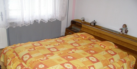
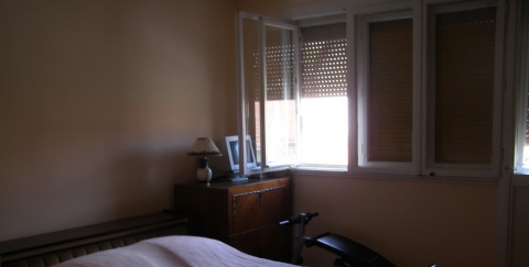
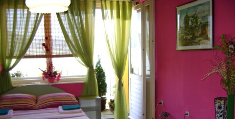
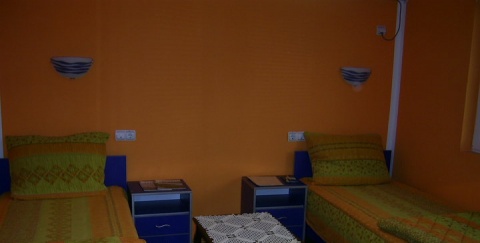
The rooms for rent – in the house of Nebojsa Mihajlovic
The rooms for rent – in the house of Nebojsa Mih...
What to do
Danube experience