EN
EN DE
DE
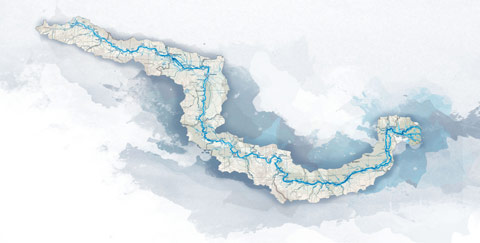
Cycling trail in Serbia, SECTION 5: Beograd - Pancevo - Kovin - Banatska Palanka
From Terazije square we move to the direction we came from (southeast). After about 100m we turn left at the traffic light and arrive at Nikole Pasica square. Behind that square is the building of National Assembly (on our left side). We drive on the boulevard Kralja Aleksandra (a wide road with fou...
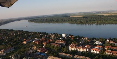
City: Belgrade
Country: Serbia
Cycling trail in Serbia, SECTION 5: Beograd - Pancevo - Kovin - Banatska Palanka
Section 5:
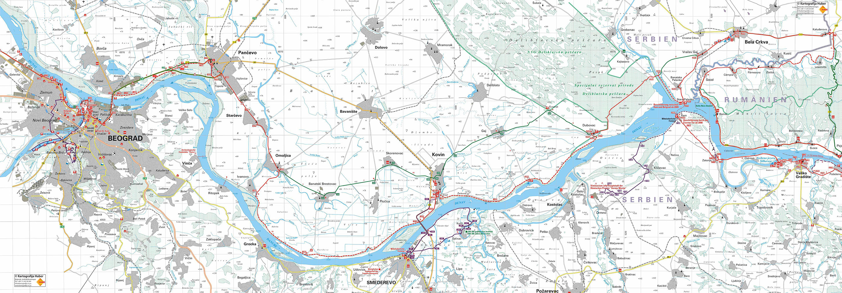
Beograd – Pancevo – Kovin – Banatska Palanka (107km)
- Map (2,056Kb)
GPS tracks logs & waypoints for this base *
Section West: (Sections 1- 4: Backi Breg - Apatin - Backa Palanka - Novi Sad - Belgrade)
Section East: (Sections 5-7: Belgrade - Pancevo - Ram - Golubac - Đerdap - Kladovo - Negotin - Bregovo)
E – Food
U – Sleeping accommodation
Note: Complete text and GPS marking was done by Ciklonaut Serbia, e-mail: jone@ciklonaut.com
From Terazije square we move to the direction we came from (southeast). After about 100m we turn left at the traffic light and arrive at Nikole Pasica square. Behind that square is the building of National Assembly (on our left side). We drive on the boulevard Kralja Aleksandra (a wide road with four lanes, with tram tracks in the middle) to reach Vukov Spomenik square. Behind the massive building on the left (National Bank and Main post office) are Tasmajdan park and the remarkable Church of St. Marko. Instead of driving on the busy boulevard, we use the footpaths through the park, which is parallel to the boulevard, and drive towards Vukov Spomenik (if you use the track lag for this base, it will lead you to the same road).
At Vukov Spomenik square we should turn left to head towards Danube. Directly next to that crossroad is a monument to Vuk Karadzic, the reformer of the Serbian language and spelling, one of the most recognized historical figures of Serbia. At this crossroad are tram tracks,which part at this point– one track leads to the Danube, so we can follow that one straight ahead along a lengthy Ruzveltova street. After approximately 1,5km we reach a roundabout, where we drive anti-clockwise and take the opposite exit, which leads us downhill. After less than 100m we get to a right hand bend that leads to the Pancevo Bridge (Pancevacki most) over the Danube. If we follow this street we are at the beginning of the bridge after ca. 1km.
If you followed the route given above, from Terazije square (Belgrade centre) to this place, you would have covered about 4,6km. Since many bicyclists will probably find other routes through the city, we shall take the beginning of the bridge as mileage for the 5th base (the place where the bridge begins).
Why you should not be driving on the right riverside of the Danube to get from Belgrade to Smederevo?
a) Because this way is much more exhausting – you are driving on mountain terrain up and down and there are many rises, which are some kilometres long.
b) The gateway from Belgrade is further away if you choose this route. And you drive uphill until the gateway on a very busy boulevard, one of the main veins in the city. Even after you exit Belgrade, the traffic is very intense for more than 15km. The road is very narrow here and therefore known for many car crashes.
c) The asphalt on the road to Smederevo is damaged at many parts (road holes, patched asphalt…).
What is more, roads on the left riverside of the Danube (across Pancevo) are in much better condition, the terrain is flat and the traffic less heavy.
Belgrade, beginning of the bridge, Pancevacki most – 0km
The bridge is narrow and one of the busiest sections on the Serbian Danube route. Fortunately, narrow footpath (wide enough for bicycles) starts at the beginning of the bridge – therefore we recommend crossing the bridge using that footpath instead of the lane.
1,1km
We arrive at the end of the bridge. The footpath is followed by a sidewalk which will lead us to the right.. Notation: if we choose the asphalt road to get to Pancevo (have a look below), we should not turn right here, but drive straight ahead and follow the markers “Vrsac – Pancevo”.
1,3km
R68 – at this point of the sidewalk we shall turn right to a gravel road, which leads us immediately to the bank. [At this point there is another gravel road bending to the right– which we can take to reach restaurant Konoba (E) after 500m. This beautiful restaurant lies on the riverside and has a huge terrace and garden.
The road alongside the bank is made of earth and gravel. The road is fine for driving on sunny days, and it is worth mentioning that it is not at all busy and that it runs across magnificent landscape.
Alternative: main road from the Pancevacki Bridge to Pancevo (11km)
During heavy rain we have to take the main road to reach Pancevo. Actually, it is a motor way, but since it is the only asphalted road from Belgrade to Pancevo and is considered a city street, bicycle rides are allowed. There is an emergency lane on this road which we can use and the ride is rather undisturbed.
R68: 0km
We shall now follow the road signs to Pancevo. After we exit Krnjaca, suburb of Belgrade, the road leads us across a marshland greenery and the traffic is less busy.
6,8km
Ra15 – a V-shaped crossroad where we have to turn right – this highroad branch leads up a crossover and then turns into a normal street. (If we do not want to ride through Pancevo we can go straight ahead, using the by-pass around Pancevo. Even though this part belongs to the highroad, the traffic is moderately busy).
8,8km
The restaurant Bakana (E) on the right side of the road.
10,9km
R71 – the place, where the bank road (main bicycle route) crosses our road.
2,5km
If you changed your mind concerning the drive on the bank, here you have the possibility to get to the main road towards Pancevo: on your left is a little road, which leads us to the 200m distant asphalted road and then to the main road. However, our bicycle route leads us straight ahead. Soon we pass a barrier on the bank.
While riding on, we should notice a parallel but non asphalted road beneath the bank, which is mainly in good condition – we can use that road, too.
6,8km
Here is another place, where we can exit the bank road, if we want to do so: In front of the watchmen house goes a gravel road to the left, leading to the main road. If we stay on the bank road, we will ride past numeral ponds on the right, which resulted from gravel mining. The people living near the Danube call them Kubici. (In the figurative sense Kubici means “dig” because the worker in former times called the things they dug out “Kubikasi”. Probably because their work was measured in cubic centimetres. Also the lakes developed because the holes they dug were gradually filled up with water.)
9,1km
R69 – we reach a crossroad, make a left turn right and leave the bank road for some time to drive through the tunnel under the highroad (the highroad crosses the bank here). As we leave the tunnel we can see the pathway heading to the right which will lead us straight back to the bank.
If we ride straight ahead on R69 for some hundred metres, we should get to a place where we can make a right turn, continue our ride on a gravel road and after 700m reach a weekend-colony on the Danube riverside. There is a small shop in the colony. We can also take a boat ride to reach a wonderful beach called “Bela stena”, which is on the island Forkontumac. You can get information about the boat trip in the shop – the boat is anchored nearby. The boat leaves for the beach every day during season, as soon as there are enough passengers. In autumn (starting from the middle of October) till spring, only from Thursday till Sunday – first ride is at 9 pm (the return can be arranged). Price: 70 Din. per person. Tel: 064 – 1499 – 670, Goran.
9,4km
We are now back on the bank when we immediately reach one of the barriers ahead. The barriers are usually up but if not, there is enough space to ride past it (pedestrians and cyclists are allowed to move on the bank).
9,9km
At this point begins a runway heading for the main road. We move on straight ahead on the bank.
10,1km
We pass the second barrier. The third is after 60m there.
10,5km
After we have covered about 200m of poor road (a little grassy, rough and uneven) we get to the fourth barrier and immediately reach R70 – an area where an asphalted road turns to the left and leads us to the distant main road after some 240m (we enter the main road at the restaurant Bakana). However, we ride straight ahead and remain on the bank.
12,4km
We pass the fifth barrier and arrive at Point R71 where we enter the main road to Pancevo. We turn right.
13,3km
Bridge over the river Tamis, entry to Pancevo.
(Under the bridge on the right strand of Tamis you will notice a boardwalk and a couple of restaurants (E) set above water – if we decide to make a break, the restaurants can be reached very fast riding along the pathway after crossing the bridge.)
13,9km
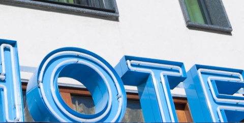
R72 – we make a right turn at this crossroad. There is big hotel Tamis to our right. A bit later we ride past a catholic church (on the right), which is in the centre of Pancevo.
14,5km
R73 – we turn left here, and then, after100m we make a first turn to the right. Doing so we get closer and closer to the city gateway (southwest direction); and we shall reach it by remaining on our course.
15,0km
Bicycle shop and repair garage - “BSP Speed”.
16,2km
R74 – at the exit of the city there is a traffic light crossroad. At this point the street we are riding on meets the by-pass round Pancevo. We drive straight ahead, cross the tracks and follow the road signs to Vojlovica. We ride through the industrial area, past a glass factory, the light airplanes factory, and finally past the nitrogen factory and the petrol refinery, Pancevo is most famous for (which are frown upon by its citizens).
20,4km
We pass the Vojlovica cloister (left). It is unusual that this cloister is surrounded by the petrol refinery; the view of that amazing church, surrounded by soulless and apocalyptic forest of pipes, reservoirs and high smoking towers will remain etched on our memory. However: it is strictly forbidden to photograph; it is possible that the police would turn you in if you used a camera. (It seems like the policemen watch very carefully: in the year 2005 there were many reports from tourists, which found themselves in an uncomfortable situation; at the end, everything turned out fine, but its better to avoid the stress)
21,3km
The restaurant Deram, at the entry of the village Starcevo (left side).
23,2km
R75 – crossroad in Starcevo. We turn right and ride through the middle of the village. There is a crossroad about 300m after R75 where we turn left. (We can follow the road signs to the main road leading to Omoljica) The street that leads through the centre of Starcevo is made of cobblestone.
24,6km
The cobblestone pavement turns into asphalt.
25,9km
Here begins of a part of the road of very good quality.
29,6km
Centre of Omoljica. A little bit further is a park with a spring – a nice place to rest a while. The streets in Omoljica are all of cobblestone (a custom in Vojvodina – main streets in villages are not covered with asphalt on purpose, so as to make sppedy drivers slow down).
30,9km
R76 – crossroad in Omoljica. To get back to the Danube riverside we have to turn right into the asphalted street.
Alternative: on the asphalted main road - from Omoljica over Banatski Brestovac to Kovin (29km)
After Omoljica the road leads along the bank to Kovin. This route is mainly not covered with asphalt, so during rain we recommend to use this alternative route. (However, on good weather we strongly recommend the main route because it’s much more beautiful!)
R76: 0km
Going along the asphalted main road we leave Omoljica and ride towards Banatski Brestovac. The traffic is moderate and the asphalt is solid.
6,1km
Ra16 – crossroad at the entry to Banatski Brestovac. To get to Kovin we have to turn left here (right turn leads to the beach (1,8km) and the camping ground Jabukov Cvet (7,2km, look below)).
The beach is also a good place for camping (nice green field), but there is nothing here but some woody tables and chairs. You can get to the beach by following this route:
- follow the asphalted road after Ra16 towards Danube
- turn right after about 700m
- turn left after another 300m into an earthy road, which leads us to our goal after 900m
Notation: although the local people say “beach” it is actually the blind canal Ponjavica, in which water does not circulate, and therefore is not so clean – we do not recommend bathing in this canal. However, the area is very beautiful.
7,5km
Ra17 – Exit form Brestovac. We turn left at this crossroad and continue our ride to Kovin on the main road. The road is still calm and the asphalt solid or rather good, patched at some parts. The landscape is dull – fields stretch out as far as we can see.
12,7km
Ra18 – by turning right you will get to the village Plocica; our aim Kovin so we will turn left.
16,6km
Skorenovac. The street on our left leads to the centre which is 400m further, but we will goon with our route to Kovin by driving straight ahead on the main road.
20,6km
Ra19 – crossroad at the entry to Kovin. Turning right leads to the Danube-bridge and towards Smederevo. City centre is ahead of us, and we ride towards it. There are a couple of restaurants at the crossroad because this place is a popular resting point for truck drivers. However, in summer this place is very popular among flies as well, which stop by in swarms from surrounding fields and stables. Therefore we do not recommend sitting outside – inside is safer.
21,3km
We ride past the restaurant Beli Bor (E) and soon after theboarding house Derby (E, U) and market place of Kovin.
22,2km
Ra20 – Turning left you get to the village Deliblato. We drive straight ahead and take a half right turn
22,6km
The restaurant Kod Ede (E).
22,8km
R82 – the place, where the alternative route crosses our Danube bicycle route.
30,5km
On the left side is the sports centre Ponjavica. (pretty ambitious name for only two fields - one for basketball and one for football.) Right after it, but to the right, is a rusty road sign informing us about entering the territory of the national park Ponjavica. We ride on an asphalted road surrounded by calm green scenery.
34,1km
R77 – we reach a little bridge, which goes over a canal towards the village Ivanovo, We do not cross the bridge but turn left towards the bank. Here starts a country road mad of gravel.
There are numerous residents of Ivanovo who, besides agricultural machines and motor-bikes, repair bicycles. If you need any help, feel free to ask the villagers – they may have just the right part for your bicycle.
The village has a little shop, a post office, an ambulance and a memorial for Russian soldiers from the 2nd world war.
If you chose to cross the bridge, you can ride on, reach the bank beside Dunav, and continue riding on the bank road to arrive at the point from which leaves a ferry to Ritopek, which is on the right Danube riverside. Ritopek at 5km distance from R77. The ferry’s leaves on every two hours, from 6 till 6 pm. The ferry is not operative from 15th December to 1st March.
34,7km
We reach the mouth of the canal and the Danube, where the bank road we rode on continues by the Danube, and we ride along. The pavement is earthy, but it is of good quality. Here we also pass a barrier (usually the barrier is down, but there is enough space to pass by with your bicycle – pedestrians and cyclists may ride on the bank). To the left beneath the bank is the watchmen house, which has a garden with a spring, and on the same side beneath the bank is a good earthy road, which we can also use because it is parallel to the bank.
36,3km
For the next couple of metres the bank road is of poor quality and overgrown with low grass (but you can move on without any problems). After that part the bank is again in good condition.
38,5km
This part of the bank road is of poor quality (like before).
38,9km
Here begins a gravel road, in good condition.
39,7km
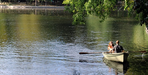
We ride past another bank-watchman house (each on every 5km). From this point spreads a beautiful view of Grocka at the opposite riverside. Several hundred metres meters ahead we reach a wonderful place on the river, which invites us to rest a while.
44,5km
About 150m after the next watchman house we reach a point where our route to Kovin goes straight ahead along the bank. By turning left at this point there is a gravel road heading for the camping ground Jabukov cvet (U). This beautiful camping ground is situated in the forest next to a narrow canal.
If we head towards the camping ground, 100m after the bank we ride past the barrier and the crossroad, where we have to turn right into an alley in the weekend-colony.
To reach the camping ground we have to ride straight ahead and in this street is the only shop in the whole area. It is in a little barrack in a private courtyard and you can easily loose sight of it. Therefore you have to pay attenion. At the gate is a doorbell that we have to press. In the court behind the shop are improvised tables and chairs (all made of wooden stumps) in the shadow of a huge oak tree.
By continuing our journey on the bank we pass an area, which is very dusty, so probably our clothes and our bicycle will get dusty, too. Our memories will include the dust, as well as: the breathing of the Danube, which you feel without seeing the water; trees, covered with a curtain of creeping plants; egrets, like silent guards reside on the ponds’ edges in the gleeful virgin forest of the marshes; the curvy road, connecting the sky and the green ahead of us; the borders of the horizon (and the whole world) become vague in the fog of the sun; the silence is impervious to the extent that it swallows up uttered words.
52,0km
We ride along a nice marsh canal. We have a clear view of the concrete, the right riverside is covered with, and so everything looks like a huge bathing area. Few bathers may be seen some, but it is sure that we are going to come across some fishermen.
52,7km
From the bank begins a road heading for the weekend-colony Plocica, where you can find a shop. We continue our ride on the bank and the quality of the road gets better. On the left side beneath the bank is another good road.
56,7km
Here starts a portion of the road of poor quality, so we can switch to the road beneath the bank. There are some houses at this point.
58,3km
We ride below a beautiful hanging bridge, which leads towards Smederevo. (The bridge is used for technical purposes only and is not meant for public traffic.) For the next couple hundred meters the road goes through the wide field and splits in two parallel roads – which one we take depends to our inspiration…
59,4km
We ride on under the bridge, where the main road Kovin – Smederevo spreads, and reach the asphalted road on the bank.
59,8km
R78 – here we leave the bank and ride on the parallel right beneath road it. (200m from this point the bank road gets bare and after 1,7km it gets even more poor and overgrown.)
62,5km
We ride past the sugar factory of Kovin.
63,0km
R79 – Left turn leads an asphalted road to the main road Smederevo – Kovin and the bridge of Smederevo, but we move on straight ahead.
Detour No.7: Kovin (R79) – Salinacker Lake – Smederevo – Kovin (R79) (38km)
The word beautiful is not reserved for the left Danube riverside only: this journey leads us on the right riverside, to the great fortress of Smederevo, to a nice lake and a miraculous forest with over 300 year-old oak-trees.
R79: 0km
If we get here by the main road we will turn left, and if we used the alternative route (Omoljica – Kovin) we shall turn right. Now we go down a short asphalted road to the main road gateway.
0,7km
We get to the main road and turn left. Maybe the lonesome bank roads and the calm side roads relaxed us too much? It is absolutely necessary to concentrate on your ride, because this road is very busy.
4,3km
We reach the bridge and cross over to the other riverside.
6,0km
We pass by the crossroad, where one branch leads to the centre of Smederevo (right), and ride straight ahead by staying on the main road.
7,8km
Rd29 – a left turn heads towards the village Salinac; we take this turn. This road is calm and the asphalt is of average or poor quality.
9,5km
Salinac Lake. Directly beneath the road spreads a mirror-like water surface, surrounded by greenery. The beach is composed of gravel, and there is a shop nearby.
11,9km
The centre of Salinac.
12,4km
Rd30 – while going through the village we reach a crossroad, where stands a small transformer station. We turn right here and after 400m, after we have passed the football stadium – (probably one of the greatest in Serbia, if you consider the landscape) we find ourselves in a forest with huge oak-trees, between 200 and 300 years of age. The view is really breathtaking: huge trees like fossil giants spread over the green grassland, some of them may have a diameter of 7 metres. It is a place fit for camping – if you like the scenes from “Lord of the Rings” when the trees come to life…
13,2km
We go back the same way to reach Rd30. Now we move on straight ahead riding on a gravel road.
14,1km
We ride through the village Kulic.
14,6km
Rd32 – we ride on the bank next to the river Morava and turn left towards Smederevo.
15,9km
A bad and barely noticeable road turns right and leads to the remains of the ancient city of Kulic. It takes about 850m to get there (it is almost on the Danube riverside) and the road going through the marsh land is passable if the water level is not too high. The vestiges of the former castle will compensate going through the marsh landscape if you really love such places.
Moving along the bank we get to the mouth of the Great Morava. But we cannot see the mouth point, where one of the most important and biggest rivers in Serbia ends its way, from the bank because of thick greenery and the remoteness (1km).
17,1km
Shorter, overgrown part of the road. Now we ride along the Danube riverside.
21,4km
We reach an enclosed part of the bank. However, beneath the bank is a good gravel road which we use to pass this part.
22,5km
Near the Smederevo Bridge the road we are riding on turns its back to the riverside and heads towards southeast, parallel to the bridge.
22,9km
We ride under the bridge where the left turn leads up to the bridge. We drive straight ahead till we reach the city. The asphalted road we are riding on is of poor quality, but the traffic is low.
27,0km
Smederevo, centre. Wonderful pedestrian area and a square with a large church. We cross the place and ride along the street heading to the north, towards the river.
27,4km
Entry to the castle of Smederevo. The castle is big, with strong walls and high towers, which are reflected in the water of the Danube. From the top you have a beautiful view of Smederevo and the river, and, if we are lucky, we can visit one of the numerous cultural art-manifestations, which take place here from spring to autumn. The entrance card for the visit of the castle is symbolic and costs 40Din..
38,1km
Again, we are at the entrance of Kovin (R79).
63,4km
A left turn leads to the bank and the nearby restaurant Ribica (E). The restaurant is on one of the most beautiful points above the wide end of the canal.
63,7km
The road turning left leads to the nearby restaurant Utva (E).
63,8km
R80 – crossroad in the suburb of Kovin. Here we turn right.
64,0km
R81 – crossroad in Kovin. The road turning left leads to the 250m distant restaurant Kod Ede (E) and to the town centre. The road turning right leads to the nearby hotel Grad (E, U). We continue our ride by turning half-right into the street going a bit downhill.
Alternative: along the asphalted road from Kovin to the village Dubovac (24km)
On the main bicycle route from Kovin to the village Dubovac are two non-asphalted parts, so we recommend taking the asphalted alternative during heavy rain. Direct route Kovin – Dubovac is not at all congested and the asphalt is good.
R81 – 0km
At this crossroad we turn left to the restaurant “Kod Ede” and the centre. Afterwards we ride on the min street. The main street reaches the end of the city and turns into the main road towards Dubovac.
1,1km
Kovin, centre.
5,2km
Ra21 – straight ahead is a road to the village Deliblato. To get to Gaj and Dubovo we have to turn half-right.
11,1km
Gaj, centre.
18,1km
Ra22 – crossroad in the village Sumarak. We stay on the main road, which bends a bit to the right here.
23,6km
At the crossroad R91 we arrive at the main bicycle route and ride straight ahead, towards the centre of Dubovo.
64,1km
R82 – R80 – you can turn right to reach the restaurants Apatin (E) and Ribica (E), but we drive straight ahead on the asphalted road. This calm road with good asphalt goes through an alley of poplar trees.
66,0km
Straight ahead is a gravel road – but we remain on the asphalted road, which bends to the left here.
66,6km
R83 – a “Y”-shaped crossroad, where the asphalt ends. We turn to the right lane. The gravel road is of good quality.
67,9km
R84 – a “T”-shaped crossroad with gravel all over the roads. We turn right (you can see that the left road is a side road).
68,6km
Gateway to the bank. Ahead of us is the river with the Zarkovacka isle. Immediately before that we cross a good but dusty gravel road, which goes parallel to the bank – we can continue our ride on this road, too.
70,5km
We pass a nice weekend-colony Manastirska rampa (right beneath the bank). At the entry to the colony we notice a beautiful spring in stone but the water is not to drink (but you can wash your face and refresh). In the weekend-colony you can arrange a crossing to Zarkovacka isle with a nice sandy beach (not cultivated).
72,1km
R85 – here we turn left and leave the bank. After 70m we reach a small asphalted road and turn right. We remain on this road, goes away from the river.
72,9km
We cross a little bridge over a small canal and drive through the village Kicinovo.
73,9km
We leave the asphalt road, which bends to the left and move on straight ahead.
74,8km
We pass another bridge over the canal. We reach the village Malo Bavaniste.
75,4km
R86 – here we turn left. The road is partially asphalted, and of poor quality.
76,1km
R87 – we reach the asphalt road in the centre of Malo Bavaniste and turn right.
78,0km
R88 – we reach a wide gravel road and turn right, towards the river. At this crossroad there are several pointers showing the way to a coal mine, grocer’s shop, restaurant and camping ground, beach and the village Beli Breg. The gravel road is flat and without any chuckholes, but with loose gravel. Therefore it is not so comfortable for riding. However, this part lasts only about 1km.
78,4km
Left turn leads to Beli Breg (there is a pointer) but we move on straight ahead.
79,0km
The road turning left leads towards the coal mine. We continue straight ahead to the bank, which is already in our sight.
79,4km
About 90m after reaching the bank road and after we rode on it for a while we reach a point where the road turns right to the nearby beach Raj (E, U). That beach is a very cosy place and well worth seeing – sand, restaurant, spring, showers, camping ground, boat- and paddleboat –renting…
The bank ground is earthy for the first hundred metres but after, that it’s a good gravel road.
84,7km
The next couple hundred metres of the road is overgrown – very comfortable in general, except from some parts.
89,7km
At the border of Dubovac we reach a point, where the left turn leads to the weekend-colony Staro selo. Directly at the beginning of that road (on the riverside) is an area, where you could camp and in the first house on the left side you could rent a boat. Directly at the rivershore is a pension in traditional style called "Marina" with 10 beds, camping possibilities and boat renting. About 800m after the crossroad, at the end of the weekend-colony, is a sleeping accommodation at Miki (U). It is cheap and fit for all those who are accustomed to minimal comfort – there is no bathroom (shower is outside, with water from a barrel), water from the spring… However, here you can meet a zealous local painter, who paints the Danube panorama over and over again.
To continue our journey along the Danube we continue riding on the bank.
90,0km
R90 – here we turn left and drive on the pathway towards the centre of Dubovac. The pathway than continues in the Danube Street (Dunavska ulica),.
91,0km
R91 – crossroad in Dunovac where we enter the main road Kovin – Gaj – Dubovac (Cara Lazara Street). We take a right turn. On the left side, about 60m after the turn, is a place where you can get drinking water (hand pump, typical for Vojvodina). Here is also a callbox. We remain on the main road for the next 12km, but we should not be worried – the traffic is low and the asphalt very good.
91,4km
Dubovac, centre. Like in other villages we have passed before, centre od Dubovac is covered with cobblestone. At the exit of Dunovac the asphalt begins again.
93,7km
Pointer marking the entry to “Deliblatska pescara (dessert)”. The landscape that spreads behind the pointer does not justify its name: we get to a pleasant forest, which we pass with enjoyment. On warm weather the smells of acacias, pines and grass get mixed up and the feeling is sublime. The traffic here is of low intensity.
94,4km
A right turn leads to the hunting lodge (U).
99,1km
The hunting lodge called Dragic Hut (U) is to the left (50m). There is a spring with drinking water in its yard..
100,2km
The tavern Đurdevak, on the right side of the road. A part of that tavern is a shop, but they only sell beverages.
100,8km
We exit the forest.
101,7km
R92 – left turn leads to the village Kajtasovo. To get to Banatska Palanka and to the ferry to take us to the right Danube riverside, we have to ride straight ahead. But for those who like relaxed places and want to escape from the civilisation, we recommend visiting a “Robinson-like” place at the end of Kajtasovo. We are talking about the grange Zeleni dvor (E, U), the owners of which are Snezena and Sava. They decided to give up their life in the city to live on a place without electricity and running water. The water is scooped from the well. Warm hospitality that comes directly from the owners’ hearts makes you forget the lack of electricity.
You have to turn left at R92 and follow the asphalted road (you should expect some chuckholes) to get to the grange. After 3,8km you reach the centre of that village and you have to move on to get to an inconspicuous wooden pointer (look carefully) which reads Zeleni dvor. (That marker is about 50m before the official marker, which informs you that you exit Kajtasova.) At this point begins a pathway to the right, which we take and after 300m we ride past the marker “Warning! Here fairytales are real”, and notice a smiling straw man and a fence. Behind that is a little house, in the middle of the forest and near a canal. Total distance from R92 to the grange is 4,9km.
We recommend camping here and to enjoying the food. On the menu are: fish, which Sava catches and prepares himself, natural soups from stinging-nettles and other herbs, cheese, vine, hard liqueur of herbs. Interesting conversation with our hosts is also on the meny.
You are always welcome, but if you travel in a larger group, we recommend to phone the hosts in advance because of the food preparation. You do not have to pay for camping and you can pay whatever you want for the food, which means it is not expensive but you should not be stingy: besides selling the fish, this is the only source of income for these people.
102,4km
We cross the bridge over the canal Danube – Tisa – Danube. The canal is used for irrigation and the shipping traffic and it is the artery of Vojvodina, as it spreads throughout the whole region. After the bridge we reach R93. Here we turn left into that road towards the bank along the canal waterside (asphalt is just in the first part, after that continues earthy road).
Alternative: on the asphalted road through the villages Vracev Gaj and Banatska Palanka, to Stara Palanka and the ferry to Ram (12km)
There is a non asphalted part of the road on the bank along the canal Danube – Tisa – Danube, so that we recommend using the asphalted alternative on rainy days. This road is not congested, and the asphalt is good..
R93 – 0km
We continue straight ahead at this crossroad, following the main road.
0,9km
We pass the beautiful, solitary grange on the left. We can spend the night camping near the grange entry. The owner is very friendly and surly allows camping here, but nevertheless we should be polite and ask him. An earthy road turns right and leads to Banatska Palanka; this is a 3km long shortcut through a wonderful, hilly and overgrown landscape – midget-size Mongolia.
We move on straight ahead on the asphalt. Landscape ahead of us is picturesque: calm, overgrown hilly landscape, here and there a shepherd with his flock of sheep.
5,7km
Ra23 – this crossroad is at the entry to Vracev Gaj. Straight ahead you get to the centre and after that to the village Bela Crkva. However, we turn right to Banatska Palanka. This road is calm and asphalt is good.
10,2km
Banatska Palanka, centre. We continue our drive on the main road to Stara Palanka. This road bends to the left in a right angle and a little later bends right in an acute angle.
12,1km
At the entry to Stara Palanka we reach Ra24, a “V”-shaped crossroad. Both branch roads lead to the ferry dock, but the left one is shorter.
12,4km
Ferry dock to Ram.
107,0km
Stara Palanka, ferry dock to Ram. There are three taverns here: Dela, Sunce and Dunavski cvet (E). On the right side of the dock is the restaurant Dunav, where you can spend the night. The restaurants Dunavski cvet (Danube flower) and Dunav have terraces with a view of the river which makes waiting for the ferry pretty much enjoyable. And, even more, its worth missing the ferry to have a wonderful lunch here.
The ferry drives from 1st May to 1st September from 6:15am to 8pm every 40 minutes (enough time to eat some fish soup and have a drink). In October, November and March there are 4 departures a day (6am, 10am, 11:30am and 3pm). In December, January and February the ferry leaves 3 times (7am, 10am, 1:30pm).
It takes about 25 minutes to cross the Danube and it will remain forever etched in our memory because the river is very wide here and the view is fantastic. The ferry dock is at the end of the canal Danube – Tisa – Danube and we will leave it after 200m: On a sunny day, the mere sight of that big and water mirror will take our breath away. If we open our eyes and listen carefully we can hear the quiet and ceremonious clangour, when the sunrays meet the water. The ferry does not have its own induction motor but is pulled by a little boat, so we will not feel any vibrations, which could bring us back to reality: the ride to Ram is no seafaring but a flight on a magic carpet.
If we have time, we should visit the village Bela Crkva, which is 12km away from this point (if we take the alternative route over the village Vracev Gaj, which is mentioned above, it takes only 5,5km to get from Point Ra23 to Bela Crkva). Halfway down our set route we see lakes, developed from the gravel excavations. The biggest lake has a cultivated beach and a camping ground nearby, and couple of restaurants as well. Everything is surrounded by greenery. Other lakes also have small gravel beaches.
1. Regarding waypoint you are interested in always check in your GPS the field with its additional description: there you can find full name of the waypoint as well as various additional information.
2. Waypoint system is designed to show direction down the river; for example waypoint “asphalt start” means the asphalt starts at that point when you have in mind defined direction – if you travel up the river stream this would then be the place where asphalt ends.
3. Situation at the field continuously changes, therefore GPS data here given can be changed or updated – that is why we recommend that you download the data from the web site right before the planned journey.
4. If you find some inaccuracies or you wish to add some new GPS data you find important, please inform us using this address.
Explanations for abbreviations used in waypoint denotations:
• Number without any letters: number of the crossroad at the main route (corresponding to the number on the map and number on the sign-post at the field)
• Alt + number: number of the crossroad at alternative route (corresponding to the number on the map and number of the sign-post at the field)
• D + number: number of the crossroad at detour
• S: turning point
• Vo: water (spring, drink-fountain etc.)
• asf st: beginning of the asphalt road
• asf end: end of the asphalt road
• cycl: bicycle parts selling store and/or bicycle service and/or bicycle center
• Muz: museum
• Ht: hotel
• Mot: motel
• P: pension
• car: čarda (fish restaurant)
• kaf: tavern
• T: tunnel
• Names of inhabited posts are written with capital letters
DANUBE.TRAVEL has no control over the website content generated by users and/or visitors, neither such content represents a statement, opinion, recommendation or rating by DANUBE.TRAVEL. For further information please refer to DANUBE.TRAVEL – General Website Terms and Conditions of Use.
Places near this location
Where to stay

What to do

Danube experience