EN
EN DE
DE
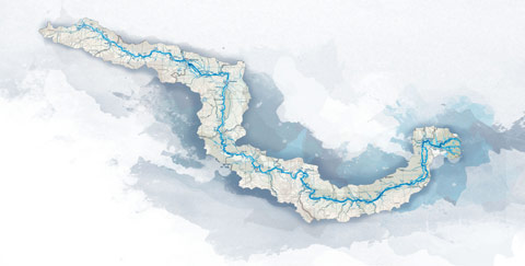
Cycling trail in Serbia, SECTION 4: Novi Sad – Belgrade
Since there are probably many travellers by car who will find different ways through the city, we will take Petrovaradin Bridge as a starting point for our 4th base mileage. Novi Sad, the beginning of Petrovaradin Bridge (Petrovaradin most) – 0km......
City: Novi Sad
Country: Serbia
Cycling trail in Serbia, SECTION 4: Novi Sad – Belgrade
Section 4: Novi Sad – Beograd
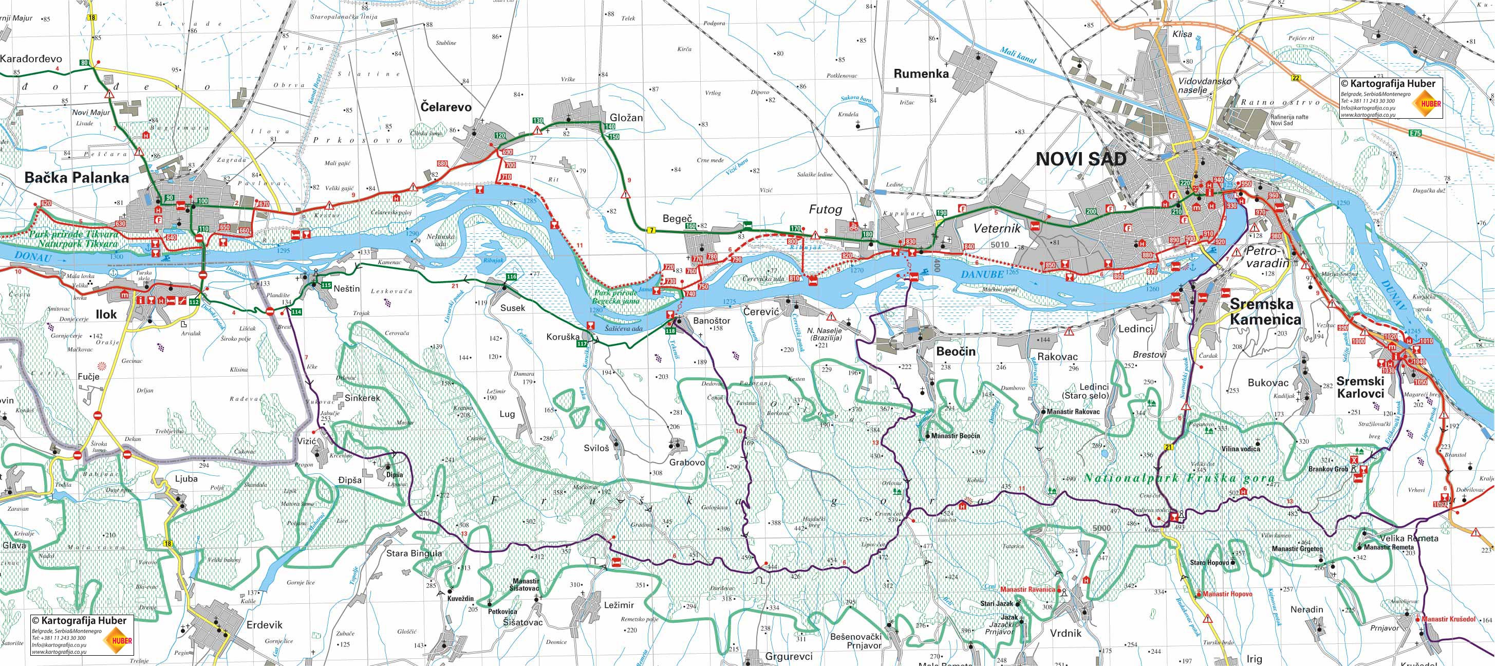
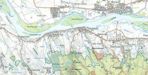
• Map (2,253Kb)
• GPS track logs & waypoints for this base *
Section West: (Sections 1- 4: Backi Breg - Apatin - Backa Palanka - Novi Sad - Belgrade)
Section East: (Sections 5-7: Belgrade - Pancevo - Ram - Golubac - Đerdap - Kladovo - Negotin - Bregovo)
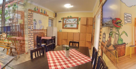
E – Food
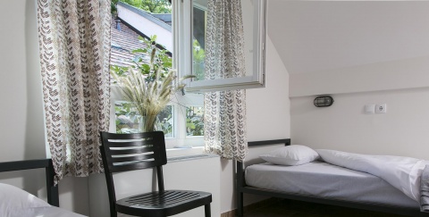
U – Sleeping accommodation
Note: Complete text and GPS marking was done by Ciklonaut Serbia, e-mail: jone@ciklonaut.com
Since there are probably many travellers by car who will find different ways through the city, we will take Petrovaradin Bridge as a starting point for our 4th base mileage.
Novi Sad, the beginning of Petrovaradin Bridge (Petrovaradin most) – 0km
The traffic to Sremski Karlovci is very intense and the road is very narrow. The asphalt is good.
0,6km
We pass by Petrovaradin Fortress which one should devote couple of hours to visit. The fortress is huge, from the top plateau there is a wonderful view of the Danube, Novi Sad and its surrounding. There are a hotel and a restaurant with their ideal location as well.
2,8km
R47 – a V-shaped intersection. On the right there is a road to Sremska Kamenica and Fruska Gora but we will turn semi-left to Belgrade.
6,8km
R48 –On the right beneath the intersection there is a spring, an earthy road on the left. We continue straight but if the weather is nice we can use the earthy road.
Alternative: earthy road from R48 to the hotel and the Czarda Dunav in Sremski Karlovci (2.5km)
Instead of continuing straight at the Point R48, we can turn left to an earthy road, which leads along the bank and finishes near the hotel and the Czarda Dunav (have a look beneath).
7,4km
R49 – a V-shaped intersection. If we continue straight we would make a detour around the centre of Sremski Karlovci – therefore we will turn right because this very pleasant and beautiful historic city is worth visiting.
9,0km
Sremski Karlovci, the centre. The little square was developed during the last two centuries. It is surrounded by beautiful old buildings from the 18th and 19th centuries, decorated with two churches- one orthodox and one catholic- and a grammar school. Sremski Karlovci is known for good wine; so this is a good opportunity for wine tasting.
At this point we can turn left, to the river if we want to drive to the 600m distant hotel and to the Czarda Dunav (E, U). Both hotel and Czarda are beautiful and are located in a beautiful place. If we want to move on to Belgrade, firstly we have to turn right at the square in the centre and after approximately 80m we have to turn first street left. Moreover, this street will lead us to the end of the town- this version is our main route
10,6km
R50 – exit from Sremski Karlovci, entering the main road.
10,8km
There is a cultivated spring on the right side of the road.
11,1km
R51 (80m above the sea level) – on the right a side road leads to the 1.3 km distant railway station “ Karlovacki vinogradi” but we will continue right on the main road. We leave the Danube riverside and start a 4.4.km long rise. We climb through a low forest but this part of the road is not particularly pleasant- the rise is pretty exhausting (we climb up to 265 m above the sea level) and even though the traffic is still intense it is lighter than on the road to Karlovci.
15,5km
R52 (265m above the sea level) – end of the rise. On the right, the road leads to 3 km distant monastery “ Velika remeta”, straight ahead is the major road to Belgrade, but we will turn left to a calm side road leading across Cortanovci and Beska. Immediately a 6km long decline starts.
~19km
Section with bad asphalt.
20,5km
Entry to the centre of Cortanovci.
21,3km
R53 (136m above the sea level) – to our left an asphalted side road parts but we have to continue straight. Here the downhill finishes, which began at R52 and a new short rise starts.
22,6km (173m above the sea level)
End of the rise and beginning of a new decline to the centre of Beska.
25,2km
R54 – Right after the railway crossing we come to the intersection at the entrance of Beska. We will continue semi-left on the cobblestone pavement.
25,8km
There is a store “Anci shop” where you can get spare parts (tyres, chains) for your bicycle apart from household appliances. This is where you can find out where in Beska you can repair your bicycle (in some of the house repair garages because there isn’t any regular service-shop).
26,4km
Beska, centre (120m above the sea level) – Immediately before the centre the cobblestone pavement changes into an asphalted lane. There are bed and breakfast “Centar” (E,U) and the restaurant “Sidro” in the centre. The downhill which was 4 km long finishes in the centre. From the centre of Beska we continue straight. The road is of good quality, the traffic is moderate and the terrain all the way to Belgrade is plain.
Detour No.5: Beska – Danube riverside – Beska (10km)
Beska, centre – 0km
At the beginning of this detour which will take us through beautiful hills and leads us to a beautiful place on the Danube riverside, we should turn left towards the river in the centre of Beska. Soon after this the rise begins.
3,6km – end of the rise (186m above the sea level). We are on the top of the hill Madackovi breg, where is a beautiful view both across Beska and the Danube. From this part there is a steep decline towards the Danube riverside.
4,6km
Rd26 – the asphalted road on the left leads to the restaurants “Bela Ladja” and “Sidro” and also to the river.
4,8km
The hotel Bozic (E, U).
5,0km – the restaurants “Bela Ladja” und “Sidro” (E), the Danube riverside. The return to Beska is on the same road.
28,0km
R55 – on the left there is an exit to the highway Belgrade – Novi Sad. We drive straight ahead.
30,4km
A cobblestone pavement begins.
31,8km
Krcedin, centre. We continue straight.
32,6km
The cobblestone pavement turns into an asphalted road.
36,0km
R56 – the asphalted road turns left (towards the village of Vinogradi) but we have to drive straight on a cobblestone road, which starts from here. This part of the road ahead is about 3,8km long. The cobblestone is of good quality but it turns into an earthy road later (we expect this road to be asphalted very soon).
39,4km
R57 –a crossroad with earthy side roads; we move on straight ahead.
39,8km
R58 – a V-shaped intersection. We will turn left. Approximately 100m after the intersection an asphalted road begins.
41,1km
R59 – we are entering the road Stari Slankamen- Indjija at 150 m height. If you wan to go to Stari Slankamen you should turn left (1,5km); if you turn completely left ( slightly backwards) it will take you to a monument (detour no. 6); on the right there’s a road to Novi Karlovci and Indjija. We will continue straight- on the narrow asphalted road which is opposite to the intersection. This road curves slightly across low hills and it has a nice and peaceful atmosphere.
Detour No.6: R59 – monument – R59 (4km)
A detour for those who are interested in history – it will take us to the monument devoted to the Slankamen Battle on 19 August, 1961 when Austrian and Turkish army collided. Because of bad earthy road, this detour is only recommended during good weather.
R59: 0km
The sea level on this point is at 150m height. From here we drive downhill on the very left road (asphalt).
0,45km
Rd27 (180m above the sea level) – an asphalted road stops here and a very heavy cobblestone road begins.
1,2km
Rd28 (202m above the sea level) – a side road turns right; we drive straight ahead, mainly on an earthy road.
2,1km
Monument is where the battle took place ( sea level: 231m)- it is a tall obelisk on a base which is held by four pillars. The Austrian army, under the command of Ludwing von Baden, comprised of 50000 soldiers (among them 10000 Serbs) and 90 cannons. The Turkish army, under the command of Mustafa pasha Keprili, had over 100000 men and 150 cannons. Nevertheless, the Austrians won the battle with 7300 casualties- the loss on the Turkish side was 20000 men. After their defeat the Turks withdrew from Belgrade ( The Austrian army was too exhausted to chase them).
Detour No.6b: R59 – Stari Slankamen – R59 (5km)
The visit to the village of Stari Slankamen can be very interesting. Above this village, which is situated on the Danube riverside, there are relics of the old fortress which has a beautiful view over Banat and the mouth of the river Tisa. There is an orthodox church as well which is the oldest one in Vojvodina ( opened twice a week).
From R59 to Stari Slankamen there is 1.5 km long road which is asphalted and curvy and partially cobblestone.
From there you drive downhill (from 150 to 84m above the sea level), but the last several 100metres are very steep. From the centre of the village to the top of the hill, where the relics of the fortress are, there is still1,1km long part, which you have to cover on foot. There are two good restaurants in the village: Kej and Laguna (E). Both are on the same bank of the river and have a beautiful view.
50,3km
Surduk, centre (church). Approximately 100 m before this part we pass by the café Maligan ( on the right side of the road). We continue straight. The asphalt is not that good ( with lots of patches), the traffic is light.
55km
From here the asphalt is good..
56,0km
R60 – the main road, which we still have to follow, turns right at this place. (on the left there’s an asphalted road towards a weekend-colony)
56,3km
Belegis, centre (church).
57,2km
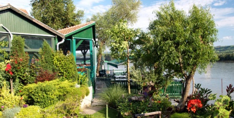
On the left side of the road there is the restaurant Saran (E). Next to it begins a small road, which we can follow to get to the Danube riverside. This part of the riverside, which reaches up to Belgrade, is characteristic for its 20 – 50m high cliff made from “Löss”. (Löss – a kind of material, which is between earth and stone).
If we stop our ride on the main road for a while and go through a cut in the Loss-plateau (actually where we are all the time) we will descend to its foot after some 100 metres and arrive on a very interesting wide place between the cliff and water. A herd of cattle will probably rest in the shade of high poplar trees on wide meadows because this is a prefect place for pasture. The forest is exceptionally beautiful and bright, and it is intersected with excellent earthy lanes: if the water level is not too high it is worth driving through the forest and playing with lights and shadow. From some places in the forest skin-deep streams of water come out surrounded by very small green islands. If we are lucky enough to see cattle slowly crossing the water towards one of these islands, we will have an impression as if we were in some Asian country.
61,1km
On our left a small road leads to the restaurant Venecija (E). The restaurant is on the Danube riverside, 300m away from the main road. There’s a nice view from the terrace over the river and the opposite side of it full of trees.
If we want to rest in this restaurant we do not have to return to the major road– instead we can turn left on the first road and drive on that road parallel to the main road to the Point R61.
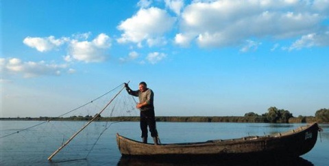
You can always see a fisherman in his boat on the bank near the restaurant, so it is possible to make a deal with him to drive you to the opposite bank. If you can convince the fisherman, you can on the other bank find roads which lead through the forest to the villages of Vrbovski and Besni Fok and finally to the road Zrenjanin – Belgrade, which leads us to the capital city.
61,6km
Stari Banovci
62,2km
R61 – There is an above mentioned parallel road on the left and we will turn right, remaining on the main road. Approximately 50 m after we should turn left following the main road (straight is the road to Stara Pazova). As soon as we turn, on the left there is a gas station and right after it the restaurant Singidunum on the right (E) * Singidunum- an old Celtic name for Belgrade). There is a short rise from here (couple of hundred metres).
63,9km
The road on the left leads to a nearby restaurant Dunavska terasa (E). An excellent restaurant with a wonderful view.
64,8km
Novi Banovci. The traffic gets more intense.
65,9km
A small street on the left parts and leads to a 300m distant bed and breakfasts Tana and Oaza (E,U) Continuing on the main road, some 450m after, this small street merges with the main road.
66,4km
R62 – Right before the crossover there is an entrance to the highway on the right. We will continue straight, over the crossover.
71,1km
Batajnica, an intersection in the centre. On the right side there is a local church. On this crossroad we will turn left towards the last few kilometres to Zemun, Belgrade. The traffic on this part is very intense and the road is very narrow– the section ahead of us is the most congested one the entire Serbian part of the Danube ( the other one is at the exit from Belgrade to Pancevo) and it will not be particularly pleasant. From the centre of Batajnica to the entrance to Zemun the road is completely flat so you will not have a problem to know where you are.
71,6km
Bicycle-shop and a repair garage on the right side of the road.
77,6km
On the left a narrow pedestrian lane starts (earth/ concrete) which we can use to avoid the heavy traffic at the entrance of Zemun.
81,1km
The hotel Lav (E, U).
81,2km
Only 80m after the hotel we come up to R63- a place where we can get away from the heavy traffic to a much calmer
parallel street all the way to the pedestrian zone at Zemun riverside. We will use this street and then we will turn to the street left and after several hundred meters to the first street right ( Pregrevica street) and continue straight.
83,3km
Balkan express – an amazing café in an old wagon, which is near the Löss – cliff high above the Danube. A beautiful view is part of the ambiance.
83,8km
After we passed the Zemun cemetery and the church on it (on the right side), we get to R64 – a crossroad where we have to drive straight ahead down to the river on the narrow street. However, before we decide to do that we can turn right towards the nearby interesting Gardos Tower. This tower was built in memory of 1000 years of Hungarian reign. Today there are two cafes (a terrace with a wonderful view over Zemun and Belgrade) and an art studio.
84,07km
After we drove down that narrow street down we arrive at the Danube riverside, the heart of the Bohemer (in former times) and the tourist-orientated life of Zemun (today). All along the bank there are numerous restaurants
85,1km
On the island (Veliko ratno ostrvo) opposite us there is a beautiful sandy beach “Lido”. During the summer you can get there by boat and almost every year a pontoon bridge is erected. There is a restaurant on the beach, nearby there is a weekend colony in “Robinson” style. There is no official accommodation on the island, but we want to spend the night there so we are hoping that we can find a place for another tent.
86,2km
The huge hotel Jugoslavija (E, U). Directly after the hotel we drive on the asphalted bank-road through the lush park “Park prijateljstva”. The park exists thanks to the world heads of states, President Tito’s guests, who brought little plants from their countries and planted them here in this park. We are already now in Novi Beograd (the border between Zemun and New Belgrade is unnoticeable).
88,1km
Bicycle shop / repair garage Bozer. There’s a nearby confluence of the Sava into the Danube, and on the other side there is a huge Kalemegdan fortress above the river. This whole area is very beautiful anytime of the year. There are more restaurants but floating on the river. We will leave the Danube for a short time ( which is not a jealous river and will not hold grudge against us) and we will drive on the left bank of the Sava.
89,2km
We arrive at the bridge across the Sava to the old town of Belgrade. We will leave the lane along the riverside, before we pass under the bridge – there is an asphalted parallel road which parts from the river.
89,7km
R65 – we will get to a busy boulevard, but we will immediately turn round 180 degrees and therefore we will get to the left side of the bridge which will take us to the old part of the town. There is a wide pedestrian lane on the bridge. On the other bank above the bridge you can notice a promenade and a bicycle lane leading to the confluence of the Sava into the Danube.- exactly where we should go. Here on the bridge there is a special lift for bicycles which makes our way much easier and faster. This lift has its working hours- if we aren’t lucky enough, we have to go down on these streets at the end of the bridge ( short instruction: at the traffic light, cross over to the right side of the bridge and go back some hundred metres: there’s a branching off which should take us to the right direction)
91,6km
We continue driving on the bicycle lane, direction to the mouth of the Sava and drive along the harbour of Belgrade.
92,6km
Confluence of the Sava into the Danube .A wonderful view over the island of Veliko ratno ostrvo and to New Belgrade.
93,7km
Sports centre “25.Maj”. On the right there are a café and a bicycle service- shop Markoni. This shop is very well equipped.
93,8km
At the border of that huge central sports centre there is R66 – an intersection where we leave the bicycle lane on the riverside and turn left, direction centre. After about 300m we pass under the crossover.
94,4km
R67 – an intersection near the zoological garden of Belgrade (on the right side). We move on straight and we expect a small rise to the hill where the centre is situated. We are driving along the park which Kalemegdan is surrounded with.
At the second traffic light after R67 we are at the highest point of that hill. On our right there is an entry to the main pedestrian avenue of Kalemegdan but we will turn left to Knez Mihajlova street, which is the heart of the tourist part of the city. This beautiful street is a pedestrian area and always full of pedestrians, so we should drive very slowly, or even walk next to our bicycles – which is not a bad idea because there are so many things that attract out attention. We will go all the way though this street.
96,1km
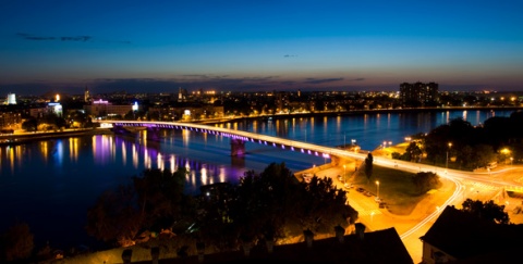
Belgrade, centre. At the end of Knez Mihajlova Street we will leave the pedestrian area behind us and we will get to Terazije square – the centre of Belgrade. In the capital city of Serbia you should spend at least one day to visit all tourist attractions (for example Kalmegdan) but also to get to know the rich nightlife, which takes place in numerous nightclubs or on river rafts on the Sava and Danube riversides..
1. Regarding waypoint you are interested in always check in your GPS the field with its additional description: there you can find full name of the waypoint as well as various additional information.
2. Waypoint system is designed to show direction down the river; for example waypoint “asphalt start” means the asphalt starts at that point when you have in mind defined direction – if you travel up the river stream this would then be the place where asphalt ends.
3. Situation at the field continuously changes, therefore GPS data here given can be changed or updated – that is why we recommend that you download the data from the web site right before the planned journey.
4. If you find some inaccuracies or you wish to add some new GPS data you find important, please inform us using this address.
Explanations for abbreviations used in waypoint denotations:
• Number without any letters: number of the crossroad at the main route (corresponding to the number on the map and number on the sign-post at the field)
• Alt + number: number of the crossroad at alternative route (corresponding to the number on the map and number of the sign-post at the field)
• D + number: number of the crossroad at detour
• S: turning point
• Vo: water (spring, drink-fountain etc.)
• asf st: beginning of the asphalt road
• asf end: end of the asphalt road
• cycl: bicycle parts selling store and/or bicycle service and/or bicycle center
• Muz: museum
• Ht: hotel
• Mot: motel
• P: pension
• car: čarda (fish restaurant)
• kaf: tavern
• T: tunnel
• Names of inhabited posts are written with capital letters
DANUBE.TRAVEL has no control over the website content generated by users and/or visitors, neither such content represents a statement, opinion, recommendation or rating by DANUBE.TRAVEL. For further information please refer to DANUBE.TRAVEL – General Website Terms and Conditions of Use.
Places near this location
Where to stay

What to do


Danube experience