EN
EN DE
DE
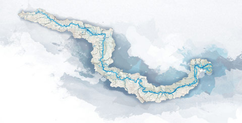
Cycling trail in Serbia, SECTION 2: Apatin - Bačka Palanka
Full description of the section from Apatin to Bačka Palanka with downloadable GPS files....
City: Apatin
Country: Serbia
Cycling trail in Serbia, SECTION 2: Apatin - Bačka Palanka
GPS tracks logs & waypoints for this base*
1. Section West: (Sections 1- 4: Bački Breg - Apatin - Bačka Palanka - Novi Sad - Belgrade)
2. Section East: (Sections 5-7: Belgrade - Pančevo - Ram - Golubac - Đerdap - Kladovo - Negotin - Bregovo)
E – Food
U – Sleeping accommodation
Note: Complete text and GPS marking was done by Ciklonaut Serbia, e-mail: jone@ciklonaut.com
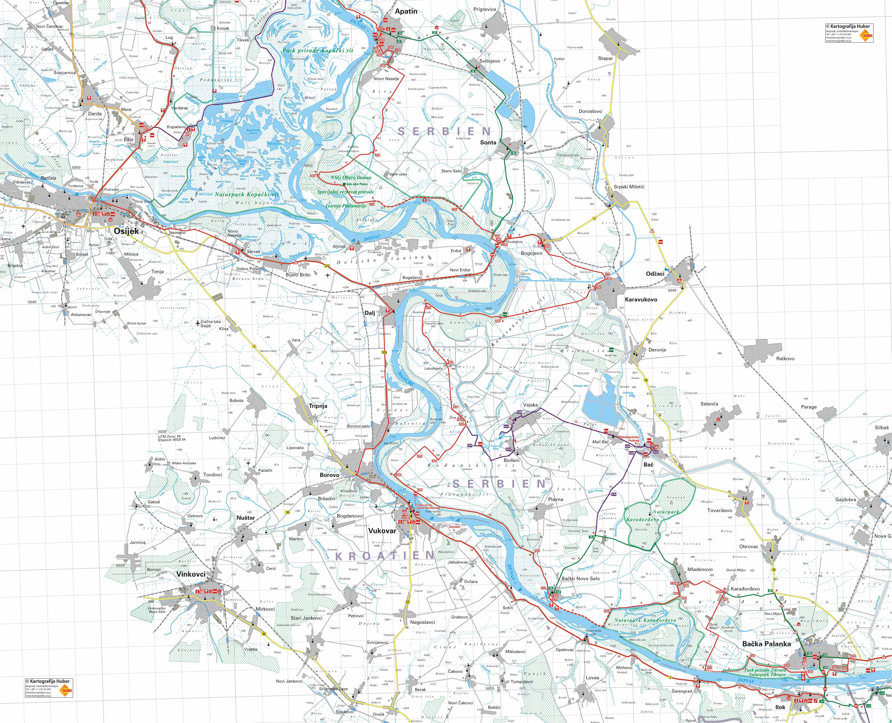
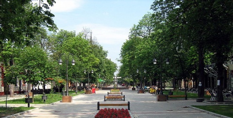
Apatin (centre, pedestrian area next to the church) – 0km Starting from the centre of Apartin we ride to the south. (Ask for the turn-off to Veliki Salas).
Alternative: Apatin – Svilojevo – Sonta – R13 (23km, green line on the map) In the latter mentioned main route, there is an 8km long, earthy part of the road, so it is recommended to use the way via Sonta if there are heavy rains. We recommend the main route which is much nicer if the weather conditions are good or satisfactory.
Apatin, centre: 0km
We will start through the pedestrian area, toward south-east and then take one of the streets which turn left. Thus we get to the main road from which we then turn right, again in the direction south-east. On the entire alternative road the traffic is either moderate or light, the drive is very monotonous.
4,0km
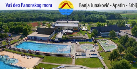
Ra1 – straight ahead is the road to the village of Prigrevica, on the left is an asphalt road to the 1km distant health resort Junakovic (E, U), but we will turn right to get to Svilojevo.
7,8km
Svilojevo – centre.
15,5km
Sonta – centre. Some 300m after this point, the main road turns left and leads us to south-west.
22,7km
R13 – the place where we connect to the main bicycle-route.
3,1km
R10 – we cross the railroad tracks and, after about 600m, we arrive at the junction on the exit from the town. Here we turn left. (At the junction you can also continue to ride straight ahead– in that case you will soon reach the bank where the asphalt ends and the earthy road begins, which is in some places in very bad condition. This road and our route meet at the hunting lodge “Mesarske livade”, at R12.). Now we follow constantly good asphalt road, which first leads us through the fields to the south-east and then, about 1,5km later, it turns 90° right to the south-west.
11,0km
R11 - In the plain we are travelling through, we will recognize the location of the junction even from far away because of the three lonely oak trees. When we arrive at the junction, these oak trees will be on our right. Here we will turn right (straight ahead is Veliki Salas) and continue down the asphalt road which leads us to the river. Short after the junction we cross a bridge over a small canal called “Riblja Voda” (translated: Fish Water).
13,1km
We arrive at a gate of a hunting ground which looks like an entry to a huge ranch. After we go through the gate we will dive into a beautiful part of the road that leads through a forest. The area that we are riding through, is called “Jelensko Ostrvo” (translated: Deer Island) so it would not be a surprise if straight in front of us, at a safe distance, a deer or a doe or maybe even a wild pig crosses the asphalt. We roll through the thick play of light and shadow, and this is the time for miracles – if we keep our eyes wide opened, we will touch one of them for sure.
15,7km
R12 – this crossing is on the bank, to which we come to immediately after we pass the turn to the nearby hunting lodge “Mesarske livade”. On this place on the bank the asphalt road begins again, and this way we have avoided the earthy part from R10, mentioned above. We continue left and a nice ride through landscape awaits us, a landscape in which our road appears to be floating between a fairytale-like jungle of trees and marsh-plants on our right and friendly looking grasslands and forests on the left. On one side - a mystic world weaved of light, shadows, bird voices and language of water which passes here and there by the riverbank , and on the other hand an open lush green bed in which dozes another day of our friendship with the Danube. Somewhere the storks will interrupt their hunt for frogs and fish to look at us wondering – is there a need to move on if the world is already complete here and fulfilled?
18,1km
On the left, circa 100m away from the bank and right next to the lonesome hunting lodge, is a very old huge plane tree. This tree is protected by law which proves the sign on it.
21,2km
The asphalt ends here – we continue straight ahead on the bank and ride the next 7km on earthy roads. (There is an asphalt road when you turn left that leads to “Veliki Salas”).
25,1km
On the right there is a small road that leads to a less than 100m distant place which is really ideal for a break or picnic – a couple of scrappy ugly assembled wooden tables and benches – all “equipped” with a wonderful view to the river. On the left beneath the bank is a house. The earthy road that we rode on to get here was excellent, further on it gets worse but is still acceptable.
28,1km
Asphalt road begins again.
31,5km
R13 – exit to the road to Sonta. We turn right, toward river.
32,9km
R14 – a crossroad where you can turn right to Bogojevo Bridge, actually toward the border crossing to Croatia, but we will continue straight ahead.
33,0km
R15 – we drive beneath the railroad tracks and follow the main road which turns left here and leads us to Bogojevo. The asphalt is of good quality and the traffic on the road is not too heavy.
Why not continue from R15 on the bank along the river to the Point R20? That would not only be the shorter but also the more attractive alternative, but unfortunately after 3km we come across a zone which is closed for civilians. The zone is not longer than a kilometre but cannot be avoided
33,7km
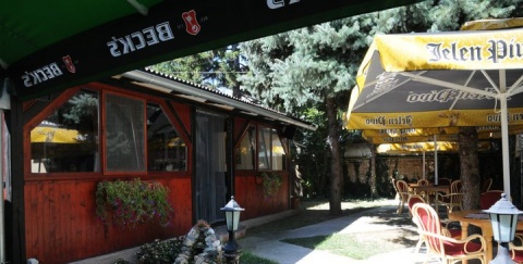
Charda Trag (E, U)
36,4km
R16 – a junction in the centre of Bogojevo. Here we turn left, to the road to Srpski Miletic.
43,0km
R17 – a junction in the centre of Srpski Miletic. Here we turn right and follow the road to Odzaci.
47,9km
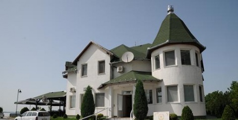
Czarda Konak (E, U).
51,2km
R18 – junction in the centre of Odzaci. Here we turn right to Karavukovo. Odzaci is a big village with a hotel and many stores, among them there is also a bicycle store and a repair garage which is modestly equipped with basic spare parts and tires. To get to this store (ST Bicikli) continue to R18 straight ahead for about 250m. The road to Karakukovo is well asphalted and with the light traffic.
56,2km
Karakukovo, centre.
57,6km
R19 – continue straight ahead down the main road
65,0km
Charda Art Caffe (E, U). The local people just call it “pub”. On the first sight it does not look like anything special – a decent little house near the bank, in the middle of the peaceful fields, on the palm of the plane – but it is another place in our route that has a soul. The distance from Paris and other metropolises nor the condition of the inventory, do not arouse any complexes: on the wall is a coloured sign which proudly says “Art Caffe” and the wooden sign on the lawn says in English (like in other metropolises): “Welcome”. There are a couple of wonderful tree crowns that are there with a sole purpose to have tables covered with chequered cloths placed underneath them which completes the picture. Here you can spend the night and buy a few tons of peace for a symbolic price of 150 Dinar, but the comfort is just for those who are prepared for the elementary conditions (though there is a bathroom with a shower).
65,2km
R20 – After the charda we drive back to the bank and move on downstream on a calm asphalt road. On the right there is a shortcut, which comes from R15 (have a look above to see why we cannot use it). Again we see landscapes and sights, which seem light years away from everyday life and urban turmoil and haste. A fisherman in his boat floats on water pulling out the net full of the afternoon Sun. A heron rests on an old log like a white statue of Osiris. A flock of goats grazes golden shining from the grassland which slowly flows into the river like lava. Geese like snowflakes melt the shadow of the creek under the crowns of mighty oak trees. A lonely fisherman rides past us with the speed of a friendly smile on his old heavy bicycle. The atmosphere of the fen takes us for a moment to the green spaces of Amazon. And always and everywhere: peace which lies in heavy layers on the dusty road or slowly flows from it into the Danube.
68,2km
Turnoff to the nearby hunting lodge Kamariste. The part of the road leads us through the forest.
71,1km
R21 – on this crossroad straight ahead the bank road continues (earthy and in a very bad condition) and on the right a concrete path leads down to the Danube. We will turn left and continue our route on the asphalt road which runs parallel to the Danube bank and it will be much easier to ride on. It is also very pleasant and the greater part of it goes through a thick weaving of poplars and other trees.
76,4km
Labudnjaca. Actually, it is only a huge dormitory for the workers from the farm, there are no stores. Further on asphalt is mostly solid, here and there it gets worse.
79,9km
R22 – on the right and backwards, the road leads to the bank, to the place where it meets with the above mentioned earthy road. We continue half-left.
80,7km
R23 – a junction to the village of Ziva. On the left a road to Vajska parts but we continue straight ahead.
81,4km
Half-left is the road to Bodane and Vajska (detour No. 4, have a look beneath) but we turn half-right.
Detour No.4: Bodani – Vajska – Bac – Backo Novo Selo (37km)
If we have time and are willing, this route will lead us along to a monastery, a nice beach and an interesting fortress.
R24 – 0km
In this case we will continue half-left at the junction R24.
2,2km
Rd15 – here we will turn left. After 600m we arrive at the turn, which leads to the nearby guesthouse Ranc (E, U). This guesthouse is in an old house on the riverside of the shadowy Berava Canal and is the ideal place to take a break: on the lawn is a pavilion made of reeds with wooden tables and benches underneath it.
5,9km
Rd16 – junction in the village of Bodani. The right side leads to a distant church which is some 200m away – we follow the main road on our left.
6,7km
Monastery Bodani.
7,6km
Rd17 – we turn left here, in the direction of a beach and a motel Provala. At the beginning of Vajska, on the right side of the junction is a graveyard.
The beach and the motel Provala (E, U). This cultivated sandy beach is on a lake which remained after the Danube’s break-in of the bank and it is the only natural beach from Bogojevo till Backo Novo Selo. Therefore during the summer weekends there can be a huge rush, but during the rest of the year it is conveniently peaceful. The motel surroundings and the lake are encircled by tall poplars.
Going south down the path from the motel, after 500m you get to a salas (a homestead) and right behind is the marsh “Negine Bare” which is decorated with reeds and intoxicating calmness. We return from the beach the same way until we reach Rd17 (9,86km) and turn left, toward the centre of Vajska.
10,9km
Vajska, centre.
11,5km
Rd18 – following the main road we turn right and continue our way to Bac.
18,5km
Guesthouse Mali Raj (E, U) (translated: Little Paradise). Convenient ambiance (fish-pond), excellent sleeping accommodation and very hospitable hosts.
19,4km
Mali Bac.
20,9km
Rd19 – a turn to the half-right leads to the centre of Bac, but we move on straight ahead to visit the fortress of Bac.
21,2km
On our left is a pathway that leads to the fortress. After taking the tour of the fortress, we continue straight ahead to the centre of Bac.
21,9km
Bac, centre. Nearby is a Franciscan convent from the 12th century, as well as a Roman-Catholic church from the 17th century. We ride down the street, passing by the Franciscan convent.
22,4km
Rd20 - to finish our loop tour through Bac and to get back on our way to Backo Novo Selo, we have to turn right here. In the street on the left side is the store “Kolibri” in which you can buy basic spare parts for your bicycle. In the street straight ahead are the restaurant Kosava (E) and a repair garage (with limited possibilities).
23,4km
About 300m after we pass the canal Karakukovo – Backi Petrovac, we ride by the guesthouse Guvna (E, U).
24,1km
Rd21 – we exit to the road to Backo Novo Selo and turn left. In the section that we have left to the end of this tour, the traffic is normal but the ride is fairly monotonous.
28,0km
Rd22 – on the right the road to the village of Plavna parts, but we move on straight ahead.
31,3km
Ra2 – on the left the road to the village of Mladenovo parts, but we continue straight ahead. Here the alternative route Backo Novo Selo – Mladenovo joins (look further down).
36,9km
Backo Novo Selo, centre
37,3km
Connection to the main route.
84,9km
R25 – Here we turn right (asphalt road on the left is a dead end).
89,5km
R26 – we reach the bank and turn left, still following the asphalt road.
101,1km
From the bank, turning left, a road parts directly to the nearby restaurant Loviste (E) (translated: hunting ground). We continue straight ahead.
102,0km
R27 – on the left is a road to the village of Plavna (asphalted, there are signposts) and to get to Backo Novo Selo you have to turn the half-right and stay on the asphalted bank-road.
105,6km
R28 – the road on the left leads to the centre of Backo Novo Selo. The last 200 – 300m on the bank we travelled on earthy road, but in case it rains, we can use the concrete path which runs parallel to the bank.
Alternative: Backo Novo Selo – Mlandenovo (15km, green line on the map)
In the latter mentioned route there is a 5km long, not asphalted road so it is recommended to use the alternative route during heavy rain showers. In this case you have to turn left on R28, towards the centre of Backo Novo Selo.
R28 – 0km
0,6km
Backo Novo Selo
6,1km
Ra2 – straight ahead is the road to Bac but we will turn right to Mladenovo. The asphalt is in a very bad condition here.
11,4km
Here the road makes a sharp turn to the right. On the left there is a short asphalt road that leads to the hotel-mansion “Dijana” (this object is half-closed character).
14,38km
Mladenovo, centre.
15km
R30 – junction in Mladenovo, here the road meets with the main route.
106,1km
On the right a little road leads to the about 200m distant charda Necko (E). Charda is on a beautiful location, in the forest full of river-poplar trees.
106,6km
The road to another beautiful charda – Mika (100m, E) starts, where you can also camp free of charge. On this junction the asphalt ends and we will continue riding on a solid earthy road for the next 3,5km.
110,4km
Entry to the hunting ground (gate). Immediately after we enter, the road leads us away from the Danube, in the direction north-east.
112,0km
The asphalt begins again. We cross the narrow Canal Mostonga and continue to the east, along the Lovrenac Canal.
116,6km
Exit from the hunting ground.
117,2km
R29 – we turn left here to get to Mladenovo. 100m after this junction we get to another one which is v-shaped where we turn half-right.
118,2km
R30 – junction in Mladenovo. To get to Karadjordjevo and Backa Palanka we will have to turn right. Here the traffic is very light.
121,8km
R31 – we turn right here, in the direction of the Danube. On the junction is the entry to the horse farm “Karadjordjevo”. Further on we will follow the narrow asphalt road which leads us through the fields.
Alternative: Karadjordjevo – road to Bac – Backa Palanka (11km, green line on the map)
In the main route, mentioned beneath, there is about 4km long earthy road, so in case of heavy rains, we recommend using alternative route. In this case we should continue straight ahead at the Point R31.
R31 – 0km
1,3km
Ra3 – on the left an asphalt road starts, we continue straight ahead.
3,9km
Ra4 – exit to the main road Bac-Backa Palanka. On the left there is a road to Bac, straight ahead is a by-pass round Backa Palanka, but we will turn right, towards the centre of Backa Palanka. The traffic on this part of the road is heavy.
10,7km
Backa Palanka, centre
Small detour in Backa Palanka
If we want to continue our journey to Novi Sad on R32 right away, we can use an asphalt road which we will notice on the opposite side of the junction (this part is marked as detour on the map). It leads us along the bank road and it will lead us under the bridge “25.maj” (border crossing to Croatia) and to the junction Rd25 on the exit of the town.
2,5km
Rd23 – the asphalt road on the left leads to the centre of Backa Palanka, but we will continue along the asphalt road that leads half-right.
On our way we could visit charda Kalos (E) which is proud of its world’s biggest cooking-tank. The cooking-tank, which can contain 4 tons of soup, is in the “Guinness Book of Records”. About 70m after Rd23, we get to a place where a macadamized road starts on the right and leads to a 200m distant charda. (The charda and the cooking-tank in its yard can be seen from the road on which we ride towards the exit from Backa Palanka).
3,7km
Rd24 – here an earthy road on the bank continues but we will turn left and follow the asphalt road that will lead us to the main road.
4,7km
Rd25 – Exit to the main road to Novi Sad; we turn right.
*Remarks
1. Regarding waypoint you are interested in always check in your GPS the field with its additional description: there you can find full name of the waypoint as well as various additional information.
2. Waypoint system is designed to show direction down the river; for example waypoint “asphalt start” means the asphalt starts at that point when you have in mind defined direction – if you travel up the river stream this would then be the place where asphalt ends.
3. Situation at the field continuously changes, therefore GPS data here given can be changed or updated – that is why we recommend that you download the data from the web site right before the planned journey.
4. If you find some inaccuracies or you wish to add some new GPS data you find important, please inform us using this address.
Explanations for abbreviations used in waypoint denotations:
• Number without any letters: number of the crossroad at the main route (corresponding to the number on the map and number on the sign-post at the field)
• Alt + number: number of the crossroad at alternative route (corresponding to the number on the map and number of the sign-post at the field)
• D + number: number of the crossroad at detour
• S: turning point
• Vo: water (spring, drink-fountain etc.)
• asf st: beginning of the asphalt road
• asf end: end of the asphalt road
• cycl: bicycle parts selling store and/or bicycle service and/or bicycle center
• Muz: museum
• Ht: hotel
• Mot: motel
• P: pension
• car: čarda (fish restaurant)
• kaf: tavern
• T: tunnel
• Names of inhabited posts are written with capital letters
DANUBE.TRAVEL has no control over the website content generated by users and/or visitors, neither such content represents a statement, opinion, recommendation or rating by DANUBE.TRAVEL. For further information please refer to DANUBE.TRAVEL – General Website Terms and Conditions of Use.
Places near this location
Where to stay
What to do
Danube experience